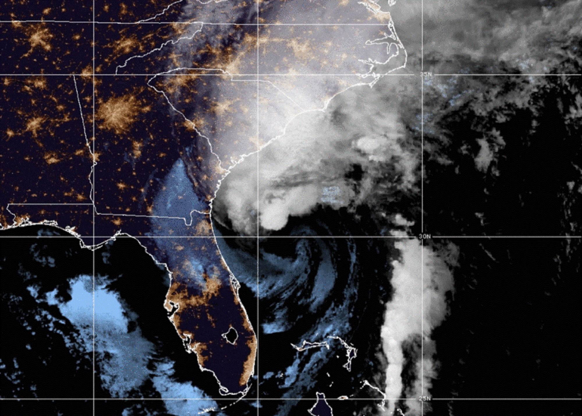
After pummeling the southeast coast of Florida at a maximum of 150 mph sustained winds, Hurricane Ian is working its way up the Atlantic and showing signs of a resurgence. The record-setting storm is set to reach South Carolina by this afternoon.
Ian first made landfall in Cuba on September 27, taking out the entire island’s power grid (which is still not fully restored). It then barreled over the Gulf of Mexico, gathering speed and power from the abnormally warm waters, and was upgraded to a Category 4 hurricane before it breached Florida on September 28. So far, 12 deaths have been reported in the state, and several parts of Lee County have been utterly demolished. The number of mortalities in the area could rise as emergency officials continue search and rescue.
From the Florida coast, Ian crossed over to the Atlantic seaboard, where it’s slowly been moving north as a tropical storm. Yesterday, the National Hurricane Center upgraded it to Category 1 again. It is next expected to make landfall between Savannah, Georgia, and Charleston, South Carolina, today around 2 p.m. Eastern.
[Related: What hurricane categories mean.]
“Life-threatening storm surge and hurricane conditions expected along the Carolina coast this afternoon. Flooding rains likely across the Carolinas and southern Virginia,” stated the National Hurricane Center in its most recent advisory. The governor of South Carolina has declared a state of emergency, but hasn’t issued a mandatory evacuation order or school closures.
While the impact this weekend should not be as devastating as that in south Florida (which experienced a rare “500-year” flood event), Carolinians should take shelter and prepare for potential disaster conditions. Precipitation from the hurricane’s remnants could be seen up the Mid-Atlantic and Northeast as well.
[Related: Rare ‘triple dip’ La Niña predicted for 2022.]
Though Ian never reached Category 5 status, its rapid intensification over the Gulf of Mexico made it particularly nasty for Cuba and Florida. This is likely linked to warmer seas and moister air caused by climate change, Vox reported. A quiet hurricane season also left the region’s waters in prime state for feeding a massive system. “We haven’t had another storm yet this season to go through and cool off the Gulf through that mechanism. There’s this pristine Gulf of Mexico from a sea-surface temperature standpoint, and Hurricane Ian has been able to exploit that,” Paul Miller, a professor of oceanography and coastal sciences at Louisiana State University, told Vox.
Ian might not be the last of the year’s major disasters: Hurricane season extends to the end of November in North America, and several weather forecasting agencies have predicted that there will be an above-average number of named storms. Not all will make landfall.
