As 2022 ends and 2023 begins, weather around the world is breaking records. In Buffalo, New York, a four day long “once in a generation” blizzard struck just before Christmas, dumping 51.9 inches of snow on the city and killing at least 37 people. In Europe, a heat wave shattered records in eight countries, as some residents rang in the new year wearing t-shirts and shorts.
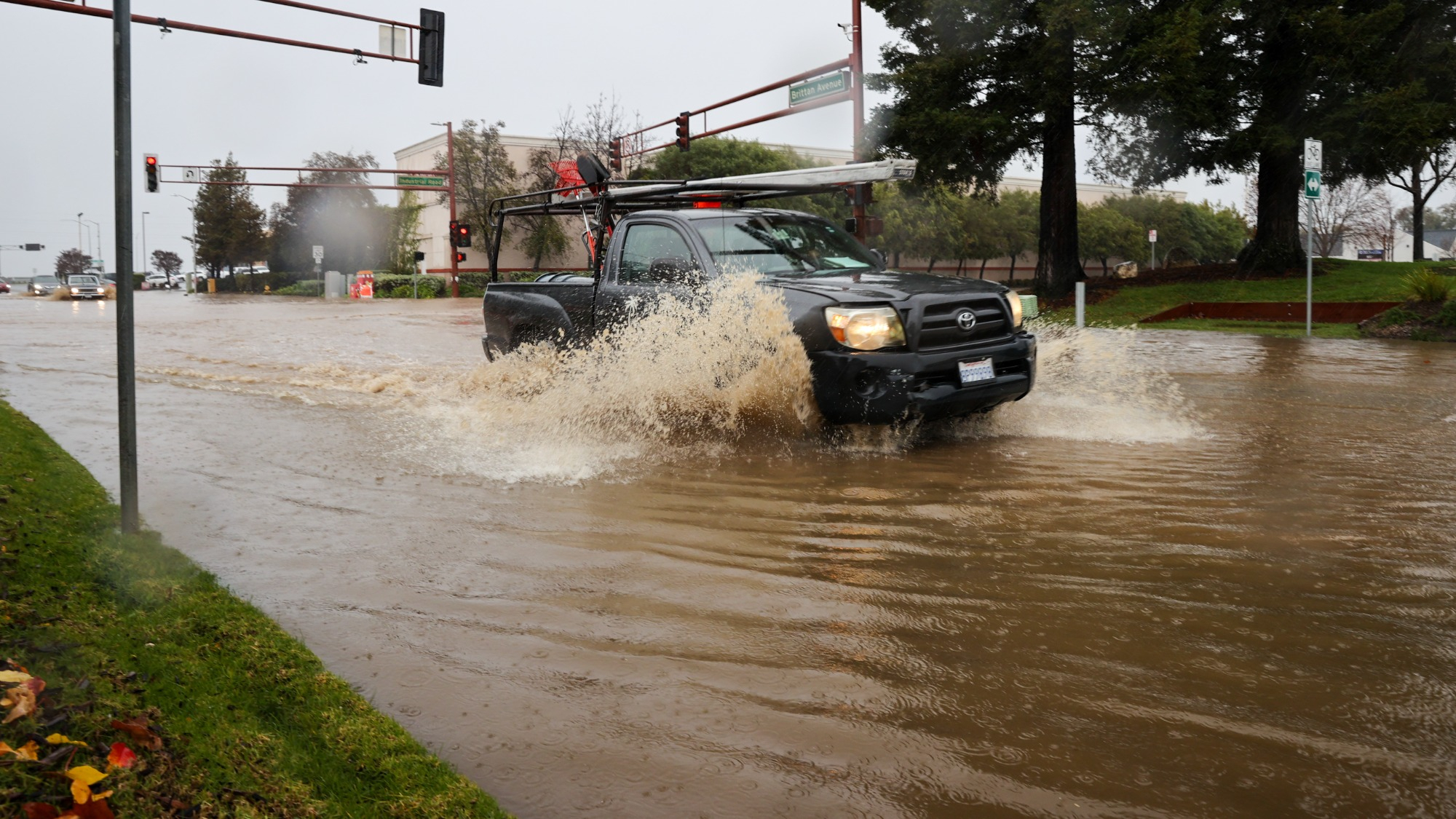
Overnight on January 4, a powerful bomb cyclone hit the northern California coast with hurricane force winds and a forecasted two to four inches rain, possibly more than six in some spots. This region is still drying out from another storm last week.
It’s the latest in a series of storms brought in by an atmospheric river, or dense moisture from over the ocean that’s brought to land an airborne current. The Pineapple Express is a well-known example of a strong atmospheric river that can bring moisture from the tropics near Hawaii across the Pacific Ocean to the western coast of the continental United States.
[Related: What more rain in the Arctic means for people, ecosystems, and wildlife.]
California Governor Gavin Newsom declared a state of emergency and urged residents to stay informed and prepare for evacuations if needed. Director of the governor’s office of emergency services Nancy Ward warned of mudslides, flooding, and power outages. “We anticipate that this may be one of the most challenging and impactful series of storms to touch down in California in the last five years.”
The city of San Francisco is bracing for more damage today. “Floods are inevitable,” San Francisco Mayor London Breed warned ahead of the storm. “It’s coming down hard and it’s not letting up any time soon. We want people to stay indoors, we want them to stay home.” The city saw flooding over the weekend after a close to record-breaking 5.46 inches of rain was recorded downtown.
The city saw mudslides, sinkholes, and localized flooding just ahead of the storm, with some of the worst of it still to come, according to Mary Ellen Carol, executive director of San Francisco’s Department of Emergency Management.
The Central Valley and Foothills remain under a flood watch and a Winter Storm Warning is in effect with regions about 7,000 feet expecting two to four feet of snow.
[Related: How disastrous floods can also lead to food insecurity.]
Drivers are also urged to stay off the roads, as heavy winds are expected to topple trees and motorists risk getting stuck in floodwaters. “If you can, if at all possible, just postpone that trip, delay it,” said California Highway Patrol spokesperson Mike Salas. “Once that car gets into that water, you just never know what is going to happen. A lot of times, we have a mechanical breakdown.”
About 180,000 customers were without electricity in the state as of early Thursday morning.
This blast of extreme weather began from a giant hurricane-force low pressure system that churned over the eastern Pacific Ocean.
Earlier this week, central and southern parts of the United States saw damage from the same multi-hazard storm system that drenched California over the weekend. Here, moist air from the Gulf of Mexico met above-normal temperatures to from severe thunderstorms. On January 3, Mobile, Alabama hit 79 degrees Fahrenheit and Pensacola, Florida broke it’s daily high record at 81 degrees.
Six tornadoes hit central Illinois, the largest number of January twisters since 1989, according to the National Weather Service. The tornadoes were spawned by “mini supercell thunderstorms.” The tornadoes damaged some buildings in Decatur, including a former bowling alley.