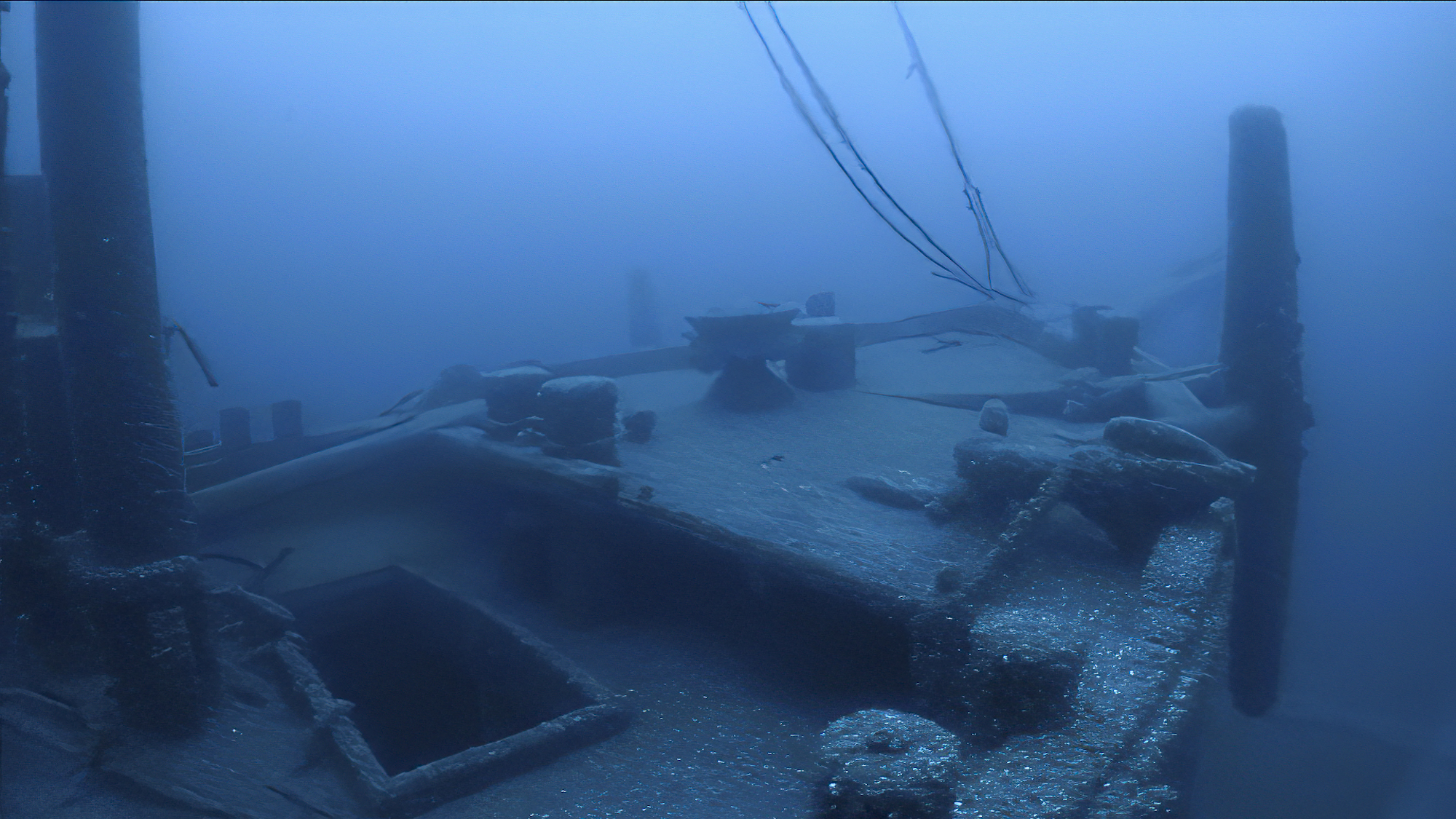
A 191-foot-long sunken ship missing beneath the waves of Lake Huron for almost 130 years has been discovered nearly intact with the help of self-driving boats and high powered sonar imaging.
At around 12:30 AM on September 24, 1894, a three-masted schooner barge called the Ironton collided head-on with the wooden freighter, Ohio, after being cut loose from a tow line in the face of inclement weather. Both vessels quickly sank beneath the waves, and although all of the Ohio’s crew escaped aboard a lifeboat, only two of Ironton’s crew survived the ordeal. For decades, both pieces of history rested somewhere along the bottom of Lake Huron, although their exact locations remained unknown.
[Related: Watch never-before-seen footage of the Titanic shipwreck from the 1980s.]
In 2017, however, researchers at Thunder Bay National Marine Sanctuary collaborated with the National Oceanic and Atmospheric Administration’s (NOAA) Office of Ocean Exploration and Research to begin search efforts for the roughly 100 ships known to have sunk within the 100-square-miles of unmapped lakebed. Using state-of-the-art equipment including multibeam sonar systems aboard the Great Lakes Environmental Research Lab’s 50-foot-long research vessel, RV Storm, the team scoured the sanctuary’s waters for evidence of long-lost barges, schooners, and other boats.
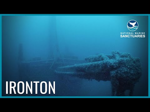
Ironton Discovery in Thunder Bay National Marine Sanctuary
In May 2017, the teams finally located Ohio’s remnants, although Ironton eluded rediscovery. Two years later, Thunder Bay National Marine Sanctuary set out on another expedition, this time partnered with Ocean Exploration Trust, the organization founded by Robert Ballard, famous for his discoveries of the Titanic, Bismarck, and USS Yorktown. For their new trip, researchers also brought along BEN (Bathymetric Explorer and Navigator), a 12-foot-long, diesel-fueled, self-driving boat built and run by University of New Hampshire’s Center for Coastal and Ocean Mapping.
By triangulating the Ohio’s now-known location, alongside wind and weather condition records for the day of the ship’s demise, RV Storm got to work with BEN’s high-resolution multibeam sonar sensor to map Lake Huron’s floors for evidence of the Ironton. With only a few days’ left to their trip, researchers finally were rewarded with 3D sonar scans of a clear, inarguable shipwreck featuring three masts.

[Related: For this deep-sea archaeologist, finding the Titanic at the bottom of the sea was just the start.]
Video footage provided by an underwater remotely operated vehicle (ROV) the following month confirmed their suspicions—there lay the Ironton, almost perfectly preserved thanks to Lake Huron’s extremely cold, clear waters. “Ironton is yet another piece of the puzzle of [the region’s] fascinating place in America’s history of trade,” Ballard said in a statement, adding that they “look forward to continuing to explore sanctuaries and with our partners reveal the history found in the underwater world to inspire future generations.”
Future research expeditions and divers searching for the Ironton’s exact resting place will have no trouble going forward—Thunder Bay National Marine Sanctuary plans to deploy one of its deep-water mooring buoys meant to mark the spot, as well as warn nearby travelers to avoid dropping anchors atop the fragile remains. The Ironton’s made it this far in nearly pristine condition, after all.
