
In 2009, NASA’s Ice, Cloud, and Land Elevation Satellite (ICESat) stopped taking pictures after six years in orbit. ICESat-2 wasn’t going to pick up the slack until 2015—and the project has since been delayed until 2018. That’s a long time in the life of Earth’s rapidly changing polar regions, where ice is changing in thickness and span with troubling speed.
That’s why NASA launched the oh-so-cooly named Operation Icebridge, a series of flights over the Arctic and Antarctic regions designed to take high resolution photos (along with additional readings) to record what’s happening in the poles in the meantime.
Operation Icebridge just completed its 2017 run over the Arctic (the Antarctic mission will happen later this year). Although the analysis of the data is still a few weeks out, the images they’ve taken are stunning—and worthy of your attention. Here are some of the best for your enjoyment.

Ellesmere Island mountaintops glow as the sun begins to peak over the horizon during Operation IceBridge’s first flight of its 2017 Arctic campaign, on March 9, 2017.

Frozen flood ponds on the sea ice, as seen during an Operation IceBridge flight on March 11, 2017.

A tributary of Knangerdlugssup Glacier, emerging from its northern wall. Note the extensive medial moraines on both glaciers. This photo was taken during an Operation IceBridge flight on May 1, 2017.

Meltwater in crevasses in southern Greenland, as seen during Operation IceBridge’s last flight of the 2017 Arctic campaign, on May 11, 2017.

A closeup of Petermann Rift on Petermann Glacier’s ice shelf, captured by NASA Operation IceBridge’s Digital Mapping System on April 14, 2017, as IceBridge’s aircraft flew directly over the crack.

A fjord in southern Greenland, as seen during Operation IceBridge’s last flight of the 2017 Arctic campaign, on May 11, 2017.

A half-dome feature at the side of Kangerdlugssup Glacier. The vertical wall of the feature facing right was formed by glacial erosion in former times, when the glacier was much thicker than it is now. This photo was taken during an Operation IceBridge flight on May 1, 2017.

The heart-shaped calving front of a glacier in northwest Greenland, as seen during an Operation IceBridge flight on March 27, 2017.

Ice flowing around a rock and out to sea in northwest Greenland, as seen during an Operation IceBridge flight on March 27, 2017.

A large rock outcropping near the Greenlandic town of Kullorsuaq (which translates to “big thumb”), as seen during an Operation IceBridge flight on Mar. 27, 2017.

Leidy Glacier in northwest Greenland, as seen during an Operation IceBridge flight on March 22, 2017.

FirnCover camp at CORE1 waypoint, showing tents, snowmobiles, sleds and science equipment, as seen during an Operation IceBridge flight on May 2, 2017.

Twisting melt channels over Ellesmere Island, as seen during an Operation IceBridge flight on March 29, 2017.

An oblique photo of a portion of the new rift on Petermann Glacier’s floating ice shelf (straight feature near bottom center), and an older curved rift from the flank of the shelf near top center. The shaded feature near bottom center is a medial flowline, the presence of which may exert a stagnating effect on the propagation of the new rift toward the older one. This image was captured during a NASA Operation IceBridge flight on April 14, 2017.

Mountains and ice of the Prince of Wales Ice Cap, as seen during an Operation IceBridge flight on Mar. 30, 2017.

Sea ice surrounds the island of Spitsbergen, as seen during an Operation IceBridge flight on Apr. 5, 2017.

View through a P-3 window of a small grounded portion of the terminus of Upernavik Central, northwest Greenland, as seen during an Operation IceBridge flight on April 10, 2017.

Along the west coast of Greenland, as seen during an Operation IceBridge flight on April 10, 2017.
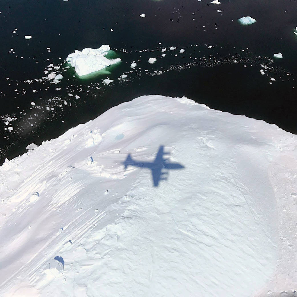
The shadow of NASA’s P-3 aircraft is seen over an iceberg on a May 8, 2017 flight supporting NASA’s Operation IceBridge mission.
