Ever wondered what’s underneath the ice–sometimes up to three kilometers thick–that covers Antarctica?
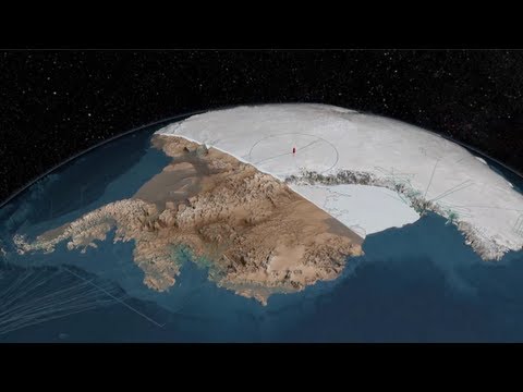
Until very recently, we weren’t really sure; maps were based on guesses and older technology. But NASA just released a video showing the results of what’s called Bedmap2, the newest and most accurate look ever at the actual landmass of Antarctica.
It was assembled by the British Antarctic Survey from millions of datasets, lots of which were supplied by NASA’s own Operation IceBridge. Operation IceBridge uses airplanes, rather than satellites, to monitor changes in polar ice, using a DC-8 and several other general-purpose airplanes. Laser altimeters, RADAR, and some odder tools like a gravimeter and magnetometer help NASA figure out what the land of Antarctica actually looks like.
There’s a purpose to Bedmap2 beyond just curiosity; the ice sheets covering Antarctica are constantly shifting and melting and freezing, and what happens down there can have major effects on our lives up here, from changing sea levels to altering the migration patters of animals. But it does also sate our curiosity.
[via Gizmodo]
