This post is being updated.
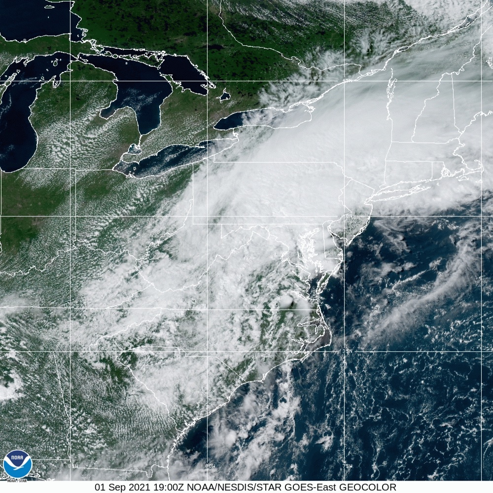
Hurricane Ida, which made landfall over the weekend in Louisiana as a Category 4 storm, is moving towards the Northeast as a strong storm, bringing heavy flash floods and tornadoes to many parts of Pennsylvania, Maryland, New Jersey, Connecticut, and New York. Even below tropical depression levels of wind, what remains of Ida may bring once in a century rains.
The National Weather service has issued its most severe flash flood warning for those parts of the Mid-Atlantic and Northeast that are expected to get three to eight inches of rain over the next day or so. Much of that rain will fall overnight for the more southerly states, then hit the northeast in the very early morning. This deluge, even after passing over much of the country, is occurring as cool, dry air along the Appalachians, prompting Ida to release most of its moisture at once.
The storm is creeping along its route, dumping massive amounts of rain as it moves up through Mississippi, lashing the region with tropical storm-force winds. Overflowing rivers are expected to last into next week, even after Ida has headed back out towards the Atlantic.
Nearly a million people in Louisiana are still without power, and will likely stay that way for weeks to come. Levees built in the aftermath of Hurricane Katrina held off the worst of the waters in New Orleans, but failures elsewhere destroyed towns. There is massive structural damage to many buildings, multiple hospitals lost generators, and widespread destruction was seen across the state. “The damage is catastrophic … primarily wind driven but we know that there were some areas that received tremendous rainfall as well,” said Louisiana governor, John Bel Edwards, at a press conference on Monday.
Ida rapidly intensified from Friday to Sunday morning, which didn’t give officials enough time to issue a mandatory evacuation for those living inside the levee system, where a voluntary evacuation order had been in place as of Friday afternoon. Ida was a Category 3 storm, as projected, early on Sunday morning, but the National Hurricane Center upgraded it to a Category 4 storm just an hour later.
The 150 mile-per-hour winds recorded make Ida the fifth strongest hurricane to hit the mainland. It’s also tied with Hurricane Laura and an unnamed 1856 storm as the strongest to ever hit Louisiana.
Ida seriously tested the fortified infrastructure that the local government has invested billions of dollars in since Hurricane Katrina made landfall 16 years ago, according to The New York Times. Those improvements have become all the more important over the last decade or so, as hurricanes have gotten stronger as the oceans warm. The high water temperatures in the Gulf of Mexico fueled Ida’s rapid intensification. So far that money seems to have been well spent, but it’s unclear at this point how much infrastructure was truly damaged.
Louisiana officials are also assessing how much damage may have been done to the state’s many oil refineries and chemical plants. At least nine refineries are out of commission or operating at reduced capacity. Destruction in those regions could mean continued suffering on top of the loss of property and lives, since oil and chemical spills can cause very different kinds of harm than wind and rain.
All of this is on top of the devastating COVID surge that’s currently raging in Louisiana. There were no ICU beds left in the entire state as of a week ago, which means hospitals are already over capacity even without the impact of a major hurricane.
