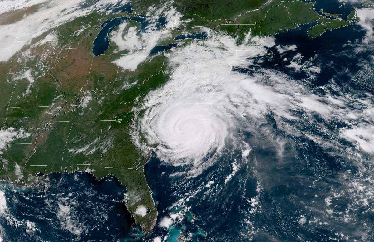

Hurricane Florence made landfall near Wilmington, North Carolina early on Friday morning, after spending much Thursday scraping the coast with intense winds and a storm surge topping 10 feet above ground level in spots. The storm will be slow to weaken as it moves away from the warm ocean waters, but even as the winds subside, the real story of the hurricane is just beginning. Forecasters expect Hurricane Florence to produce catastrophic flash flooding across North Carolina and South Carolina as the storm pushes inland through the weekend.
Coastal North Carolina had quite the night on Thursday as the core of Hurricane Florence crept toward the coast at just 5 MPH. Sustained winds of more than 80 MPH with occasional gusts over 100 MPH were reported from the Outer Banks to Wilmington as the storm made landfall. The forecast track of the storm takes it over northern South Carolina as a tropical storm through the day on Sunday before its remnants finally lift out of the area and toward the Northeast early next week.
Florence’s large and intense wind field, combined with the storm’s painfully slow forward movement, pushed a life-threatening storm surge across the North Carolina coast. A storm surge is seawater pushed ashore by strong, persistent winds. A gauge near New Bern, North Carolina, measured a storm surge of nearly 10 feet at the mouth of the Neuse River. Many other areas saw a surge greater of than five feet. Officials won’t know the extent of the damage and human toll until it’s safe to reach these areas over the next few days.

Even as the wind and surge subside, the greatest threat from the hurricane is the rain, and the rain won’t stop for a few more days. NOAA’s Weather Prediction Center expects rainfall totals in the double-digits to stretch as far inland as the Charlotte suburbs, with half a foot of rain possible all the way to the North Carolina and Virginia mountains. These intense rains will lead to the potential for catastrophic flash flooding across these areas, especially in eastern North Carolina and South Carolina.
The NWS office in Morehead City, North Carolina measured almost 14 inches of rain by Friday morning. Nearby areas have seen nearly a foot-and-a-half of rain. It’s not out of the question for parts of southeastern North Carolina to see three feet or more by the end of the storm.
This situation isn’t too unlike what we saw during Hurricane Harvey in 2017, which led to catastrophic flooding across coastal parts of Texas and Louisiana. This will be one of the worst flooding events in the recorded history of this part of the country, likely surpassing totals seen in Hurricanes Floyd and Matthew.
In addition to the wind and flooding, we can’t rule out the potential for tornadoes on the northern and eastern side of the storm. Strong wind shear in the atmosphere can allow thunderstorms in the outer bands of a landfalling tropical cyclone to turn into miniature supercells capable of producing tornadoes. The tornadoes in tropical cyclones are typically small, but they can produce considerable damage and pose a serious threat to life and property. Thunderstorms moving at highway speeds can dramatically reduce tornado warning lead time in a situation like this—sometimes giving folks in harm’s way just a few minutes of notice. If you’re near the storm’s path, pay attention to forecasts and stay safe.