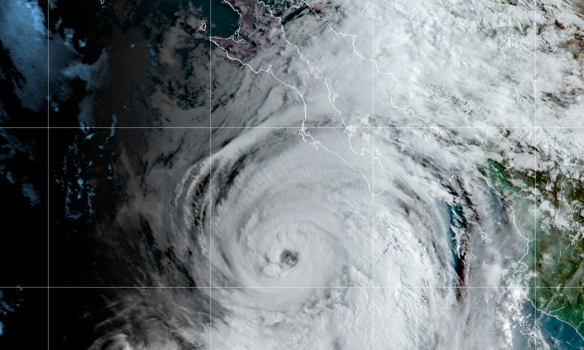
As a historic September heat wave begins to taper off in the western United States, a tropical storm is spinning a little too close to comfort for southern California. Tropical Storm Kay is moving north along Mexico’s Baja California peninsula through today, bringing with it a massive amount of moisture and potentially gusty winds and dangerous surf.
The storm is is expected to weaken until it’s about 250 miles away from San Diego and as it move along the US West Coast. This is the closest a tropical system has come to the region since Hurricane Nora in 1997. Forecasters say areas of flash flooding are probable in the region today through Sunday, with the up to five inches of rainfall possible for the interior mountains of southern California.
“Confidence remains high for a significant rainfall event across this region,” the National Weather Service said in an online discussion yesterday.
[Related: NOAA is changing the way it talks about hurricanes.]
The storm is already blamed for at least three deaths in the state of Guerrero, Mexico. Kay made landfall on Thursday afternoon as a Category 1 hurricane, near Bahia Asuncion in the state of Baja California Sur. It weakened to a tropical storm sustained winds of 70 miles per hour. According to The Associated Press, the state government of Baja California Sur said more than 1,600 people had evacuated to shelters and some creeks were rising and closed some roads. Landslides reportedly cut some roadways on the peninsula, but there were no reports of injuries.

Near Riverside, California, some thunderstorms associated with Kay have already started to rumble, with isolated heavy rain and lightning. Although the rainfall is desperately needed in the bone-dry region, the National Weather Service cautions that this moisture is not without danger. “Despite those positives, it’s never a good thing to get too much rain all at once, a trait all too common among slow-moving tropical storms,” wrote the Weather Service.
Flash flooding from the rain is most likely in burn scars (areas where fire has stripped away the vegetation that absorbs water) in narrow slot canyons, and in urbanized areas like San Diego and Palm Springs in California and Yuma in Arizona.
[Related: What is a flash flood?]
Flood watches have been posted from western Arizona to southern California. In these areas, rainfall of more than two inches is likely with up to 4 or 5 inches possible. Eastern slopes of mountains, where winds from the east will intensify the rain are most likely where this heavier rain will fall. Two to four inches of rain between today and Sunday is expected at Imperial County Airport in southeastern California. This region only sees 2.38 inches of rain per year and will break a record set in 1976 if it receives more than three inches of rain.

Other concerns with the storm are dangerous waves and rip currents and cloud-to-ground lightning from thunderstorms that could spark wildfires.
This rare California tropical storm comes as the Atlantic Hurricane Season has remained eerily quiet. “No tropical cyclones formed in the basin during August,” said the National Hurricane Center in its monthly recap. “This is quite unusual and is the first time that has occurred since 1997, and is only the third time that has happened since 1950.” Hurricane Danielle become the first named storm of the year on September 2nd with Earl quickly following behind. While it has been far from the active season first predicted, there is still plenty of time for more hurricanes in the Atlantic.
