
Eric Bender is a science writer based in Boston who primarily covers biomedical research. This story originally featured on Undark.
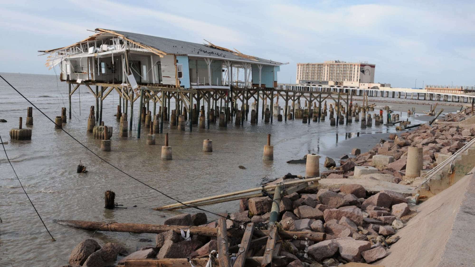
When Hurricane Ike made landfall in 2008, Bill Merrell took shelter on the second floor of a historic brick building in downtown Galveston, Texas, along with his wife, their daughter, their grandson, and two Chihuahuas. Sustained winds of 110 mph lashed the building. Seawater flooded the ground floor to a depth of over 8 feet. Once, in the night, Merrell caught glimpses of a near-full moon and realized they had entered the hurricane’s eye.
Years earlier, Merrell, a physical oceanographer at Texas A&M University at Galveston, had toured the gigantic Eastern Scheldt storm surge barrier, a nearly 6-mile-long bulwark that prevents North Sea storms from flooding the southern Dutch coast. As Ike roared outside, Merrell kept thinking about the barrier. “The next morning, I started sketching what I thought would look reasonable here,” he says, “and it turned out to be pretty close to what the Dutch would have done.”
These sketches were the beginning of the Ike Dike, a proposal for a coastal barrier intended to protect Galveston Bay. The core idea: combining huge gates across the main inlet into the Bay from the Gulf of Mexico, known as Bolivar Roads, with many miles of high seawalls.
Just across from Galveston, at least 15 people died that night on the Bolivar Peninsula, and the storm destroyed some 3,600 homes there. Bodies were still missing the next year when Merrell began to promote the Ike Dike, but, he said, the idea “was really ridiculed pretty universally.” Politicians disliked its costs, environmentalists worried about its impacts, and no one was convinced that it would work.
Merrell persisted. Returning to the Netherlands, he visited experts at Delft University and enlisted their support. Over the next few years, Dutch and U.S. academic researchers carried out dozens of studies on Galveston Bay options, while Merrell and his allies gathered support from local communities, business leaders, and politicians.
In 2014, the U.S. Army Corps of Engineers partnered with the state to study Ike Dike-like alternatives for Galveston Bay. After many iterations, bills to establish a governing structure for the $26.2 billion barrier proposal, which the Corps developed alongside the Texas General Land Office, recently passed both the Texas House and Senate. In September, the Corps will deliver their recommendations to the U.S. Congress, which will need to approve funding for the project.

No one can guess the barrier proposal’s exact fate, given its enormous price tag. And as sea levels rise and storms intensify with global climate change, Houston is far from the only US coastal metropolitan region at serious risk. Multibillion-dollar coastal megaprojects already are underway or under consideration from San Francisco to Miami to New York City.
President Joe Biden’s new $2 trillion national infrastructure initiative specifically calls for projects on the country’s embattled coasts. The initiative for Houston, the fifth-largest U.S. metro area and the vulnerable heart of the petrochemical industry, spotlights the tough decisions for coastal megaprojects, which must balance societal needs, engineering capabilities, environmental protections, and costs.
Meanwhile, the seas keep rising. “It’s a significant tension between the need to address these issues and do it quickly,” says Carly Foster, a resilience expert at the global design consultancy Arcadis, “and also do it right.”
Galveston Bay is a low, sandy subtropical estuary, bordered to the north and west by Houston’s sprawl. About twice the size of New York City, the bay is only 6 feet deep on average, with a deep channel dredged for tankers and other huge vessels traveling to and from the Port of Houston.
Given the sheer size and complexity of the Galveston Bay region, “balancing the environment and people and economics is just really tough,” says Antonia Sebastian, an assistant professor of applied hydrology and water resources at the University of North Carolina at Chapel Hill. Planners must weigh the costs and benefits, to minimize risks to an acceptable level. “And what that acceptable level is can be widely debated,” she said.
Moreover, the risks are growing. Last year, five hurricanes hit the US Gulf Coast, one with sustained winds up to 150 mph. There’s scientific consensus that climate change will cause greater numbers of these monster Atlantic hurricanes, said Ming Li, a physical oceanographer at the University of Maryland Center for Environmental Science.
As the sea rises, the land is also sinking: In the last century, the Texas coast sank about 2 feet into the sea, partly due to excessive groundwater pumping. Computer models now suggest that climate change will further lift sea levels somewhere between 1 and 6 feet over the next 50 years. Meanwhile, the Texas coastal population is projected to climb from 7 to 9 million people by 2050.
“We are absolutely going to have hurricanes hitting the Texas coast,” says Kelly Burks-Copes, an Army Corps of Engineers ecologist and project manager for the study that generated the barrier proposal. “There’s a significant barrier island system that naturally affords a defense to potential surge coming in from the Gulf, but it’s become populated over time and eroded over time. And so we are particularly vulnerable to what we call killer surges.”
Protecting Galveston Bay is no simple task. The bay is sheltered from the open ocean by two low, sandy strips of land—Galveston Island and Bolivar Peninsula—separated by the narrow passage of Bolivar Roads. When a sufficiently big storm approaches, water begins to rush through that gap and over the island and peninsula, surging into the bay.

Building on Merrell’s concept, the centerpiece of the latest Corps proposal is a massive set of gates across the Bolivar Roads. As a storm approaches, the two main navigation gates will float and swing out of dry docks to close the channel. Each will be 82 feet high—with 22 feet above water when closed and 650 feet wide—almost twice the length of a football field. These giants will be combined with two smaller swing gates, plus a set of vertical lift gates that stay open in normal weather to let the tides flow.
The Corps also plans to raise two parallel lines of dunes, which would run 43 miles along the Bolivar Peninsula and the unprotected western side of Galveston Island, fronted by 250 feet of beach. Constructing them, the Corps estimates, will require 40 million cubic yards of sand. Additionally, since a storm on the scale of Ike would wash away the dunes and surge into the Bay, the project calls for other gates and walls around the Bay, including a ring barrier encircling the city of Galveston.
“What we are proposing is multiple lines of defense,” says Burks-Copes.
Proponents also are thinking big about environmental repair, restoring 6,600 acres of ecosystems such as wetlands, bird rookery islands, and oyster reefs, some located elsewhere along the Texas shore. “We did both coastal storm risk management and ecosystem restoration and we selected sites that actually afford a natural defense system,” choosing those “that would still provide critical ecosystem habitat,” Burks-Copes says.
The coastal barrier has earned enthusiastic support from numerous local politicians and members of Congress. “We need it yesterday,” says Houston mayor Sylvester Turner in August 2020, after Hurricane Laura struck the nearby Louisiana coast, narrowly missing the Galveston Bay.
But Merrell and other experts also raise concerns about how well the Corps plan would protect the region from the worst blows. Some environmental advocates are skeptical the environmental impacts are worth the benefits. And many observers suggest that localized projects, such as raising homes and building smaller seawalls, may offer better and quicker payoffs.
Questions about payoffs begin with those immense swing gates across the Bolivar Roads inlet.
Experience with similar giant moving barriers in the Netherlands and elsewhere in Europe shows that the structures can work reliably, although each design is unique, says Bas Jonkman, a professor of hydraulic engineering at Delft University who led much of the research for the Ike Dike and its successor plans.
Jonkman compares the enormous moving parts to a jumbo jet that has to fly just once every 10 years. The barrier must be expertly operated and perfectly maintained, which turned out to be more challenging and expensive than expected after the construction of a similar barrier protecting Rotterdam, the busiest port in Europe.
Some experts are also concerned about the sand dunes slated to cover Bolivar Peninsula and Galveston Island. Merrell’s Ike Dike proposal and a previous Corps plan originally envisioned 17-foot or higher levees that would have hampered access to the Gulf beaches. Under pressure from disgruntled locals—the Corps received some 13,000 public comments about the levees, Burks-Copes said, most of them negative—they replaced the levees with dunes. But the taller dunes would be only 14 feet high, much lower than the 22-foot-high gates at Bolivar Roads. Storms no larger than Ike would wipe their sand away, Merrell and other experts have warned.
“Your whole system’s only as strong as your weakest link,” says Merrell, who continues to collaborate with academic experts to analyze coastal measures. Speaking of the Corps land barrier plan, he said “They’ve made it so weak, it’s pretty much worthless.” Far better, he said, would be a 17-foot dune fortified with clay, rock, or concrete and topped with sand.
Barriers also can’t stop the wind. When Hurricane Laura ripped into the Louisiana coast in August 2020, the houses completely exploded.
Merrell also questions the Corps’ decision to leave open San Luis Pass, the inlet to the Bay on the southwest side of Galveston Island, instead of installing a gate there. “That’s insane,” Merrell says. “That’s like leaving the back door open to your house during a hurricane.” The Corps responds that, even in a worst-case-scenario storm, water flowing through the Pass would only raise the surge in the Bay by about a foot.
Merrell and his colleagues estimate the additional cost to fortify the sand dunes and close the San Luis Pass at $10.7 billion. They argue that their measures would offer better benefits per buck than the Corps plan, which is estimated to pay back about double for each dollar invested.
No surge barrier will slow the extreme rainfalls that can unleash devastating floods, like those of 2017’s Hurricane Harvey, which killed more than 70 people in greater Houston. In fact, seawalls can trap these floods of freshwater, requiring enormous pumps to release them.
Barriers also can’t stop the wind. When Hurricane Laura ripped into the Louisiana coast in August 2020, wind losses ravaged the area, says Tracy Kijewski-Correa, an associate professor of civil and environmental engineering at Notre Dame University. Some pictures show wind damage that looks as bad as storm surge damage, she said. The houses completely exploded.
Local environmental advocates are also concerned about the impact of the project on the wetlands and fisheries of Galveston Bay.
The Corps plan slates about $2.6 billion, a tenth of the total bill, for ecosystem restoration, such as restoring salt marshes that can absorb the impact of surging seawater. “That’s a great benefit of this project,” says Michelle Hummel, assistant professor of civil engineering at the University of Texas at Arlington.
“Everybody in the environmental and conservation community is supportive of the ecosystem restoration,” says Bob Stokes, president of the Galveston Bay Foundation, a local conservation nonprofit. “We’ve also been told that that’s not going to be the first money that’s spent—that’s going to be at the end of the project.”
Stokes also is wary of the Bolivar Roads vertical lift gates. In normal weather, the gates will cut the tidal flow across the inlet by less than 10 percent, according to Corps estimates, but Stokes worries about the results of altered water movement. “The biggest concern in my mind is the fisheries impact, in the sense that pretty much all of our fish, crabs, and shrimp spend some portion of their life cycle in the Bay system and some portion in the Gulf of Mexico,” he says. Since the gates will reduce flooding, he also worries about water quality impacts. (Burks-Copes says Corps models suggest impacts will be minimal.)
In Stokes’ view, the environmental assessments performed to date are inadequate. The Corps essentially plans to analyze the environmental impacts as they get to them, Stokes says. “Our bottom line is that if we’re going to build this thing, we absolutely have to know those impacts ahead of time.”
Perhaps the biggest question on the coastal megaproject is about the $26.2 billion cost, 35 percent of which must come from the state or other local sources. So will all the operating costs, estimated at more than $100 million a year. The timeline is protracted, too: The Corps estimates that, even with a quick legislative greenlight, the project would not be completed until around 2042.
There’s no lack of smaller-scale alternatives, most of them based on measures that are far cheaper and quicker, such as flood-proofing businesses and raising homes. Even when such options can’t offer much protection against mega-storms, they can guard against smaller events and the regular nuisance flooding that’s becoming more of an issue with sea-level rise.
These localized programs often can lower risks significantly and don’t take decades to complete, said Paul Kirshen, professor of climate adaptation at the University of Massachusetts in Boston, who led a study that rejected an outer harbor barrier for Boston in favor of onshore measures. Local improvements also can protect key infrastructure such as power stations and hospitals.
They also may be more immediately affordable than giant initiatives. The American Society of Civil Engineers estimates that the US needs to spend $2.59 trillion—more than a third of the entire federal budget for 2020—to bring infrastructure up to standard. Meanwhile, other cities are seeking federal dollars for billion-dollar-plus coastal proposal, and Biden’s infrastructure plan, which initially called for $50 billion for such projects, remains stalled in the Senate.

Still, many experts are skeptical that patchwork solutions are up to the task of protecting coastal cities from rising seas and amplified storms.
Given all the uncertainties about climate change in the decades ahead, “we’re going into uncharted waters,” Kirshen says. “All of our solutions have to be questioned.”
And there are large and growing swaths of coast where the sea simply can’t be warded off for many years. “Are there points at which we can strategically retreat?” Sebastian asks. “And if we do strategic retreat, how do we do that in an equitable way with consideration of everybody’s ties to place? Those are really the hardest questions to ask. But I do think, in the context of talking about spending billions and billions of dollars on the coastal spine, those questions should be asked.”
“We have to think big,” Li says. “If you just have a Band-Aid solution, it’s not going to work.”
Merrell can’t guess exactly what will end up being built, or when, in Texas. But he does expect action there—and elsewhere around the US. We’re slowly shifting from recovery as our strategy to prevention, he says. “You don’t switch policies quickly and easily. We ought to expect this to be hard and a bit chaotic.”

