
In January 1992, during what might have been a rough storm, a cargo box containing more than 28,000 rubber ducks and other bath toys toppled overboard, off a ship traveling from China to Seattle. These rubber toys, known now as the Friendly Floaties, were set adrift, and as they’ve washed up in places like Hawaii, Australia, and even Japan, they’ve revealed an invisible worldwide network of currents that have made huge ripples in ocean science.
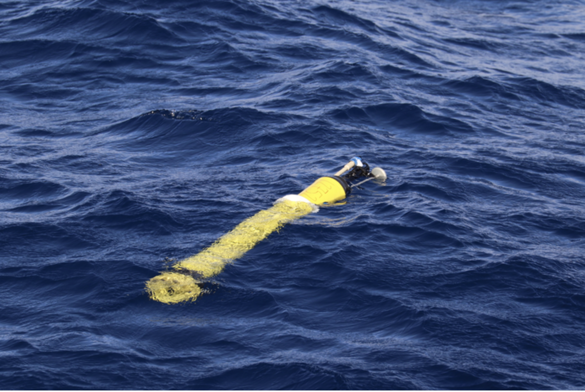
But serendipity is certainly not the only way to learn new things about the seas. Imagine the possibilities if these rubber ducks were filled with sensors, and could relay the information they picked up from floating around in the ocean to a global database. This possibility is now a reality in the form of Argo floats: an array of free drifting aquatic robots that can measure pH, salinity, temperature, and more.
Now, a new study in Nature Geoscience has shown that they can also measure productivity, or how much oxygen the plants of the ocean—algae and plankton—make. “We’ve really just been flying blind in terms of being able to quantitatively measure what the plankton do,” says Ken Johnson, senior scientist at Monterey Bay Aquarium Research Institute, and an author on the paper. “That’s the base of the food web. The plants feed the krill, which feed the fish, which feed the whales. We can now measure this.”
The ability to measure productivity and how it’s changing in a warming world could not only inform scientists about ocean health, but could also impact the operation of fisheries and people whose livelihoods depend on the sea.
Historically, scientists mainly measured productivity in one of two ways. The first was through ocean color satellites, which measured the amount of chlorophyll in the water. Researchers can then use a mathematical model to estimate the corresponding amount of phytoplankton there is. But satellite data can’t really measure changes in productivity from year to year, Johnson says. The other way was through intensive field work. That means researchers had to get on a ship, go out to sea, collect a sample of water, add radioactively labeled carbon to the sample, wait for the plankton to take it up, then filter out the plankton and count how much of the labeled carbon were in the plankton.
[Related: A tuna robot reveals the art of gliding gracefully through water]
“The beauty of [the robots] is that it doesn’t require someone getting on a ship and going out, which is incredibly expensive and difficult to sustain, and no one wants to be there 365 days a year,” Johnson says. “You can’t afford it.”
How does the Argo float work?
The first ever Argo float was set to sea in 1999, but since then, new sensors have been added, and its design has been updated.
A basic Argo float looks like a gas cylinder that you might spy in a chemistry lab. It’s a little over four feet tall, spanning eight inches in diameter, and stocked full of batteries. On the top of the float are sensors and a satellite antenna. Inside the body is a buoyancy engine, which consists of a small bladder that can inflate with about a cup of oil, adjusting the density of the float.
Typically, in one complete cycle, the float will go down to 1 kilometer, or around 3,280 feet deep, remain there for a few days, and then go down to 2 kilometers. (They stay at 1 kilometer because currents there are much slower, so that minimizes how fast they spread out.) Once at that depth, the float will turn on all its sensors and slowly ascend to the surface. They store all the data they collect, and once they break through the waves, the GPS signal will activate, and it will be able to “phone home” through an iridium satellite network. All the data collected will be available within 24 hours.
Argo floats resurface after each cycle, which takes about 10 days or so to complete. They have enough battery power to complete 250 cycles in their lifetime. Some Argo floats are set to come up at the exact same time each day, while others can give a more random, hourly sample of the ocean.

The subset of Argo floats used for this study are called biogeochemical Argo floats (BGC-Argo), which can have additional sensors that measure nitrate, oxygen, chlorophyll, and light. These sensors can relay information about the concentration of plankton in the water, how much they are growing and respiring, the amount of oxygen they’re producing and carbon dioxide they’re uptaking. Previously, they’ve proved useful in helping scientists investigate algal blooms.
The average life of a float is around 4 years. They’re not immune to mishaps, and they’re certainly not indestructible. “They can disappear,” Johnson says “Sometimes we will see the last profile of a float and they just happen to go down right on top of a seamount and they will get caught on the bottom, and a year later, they’ll get uncaught and come to the surface.”
For this study, since there were so few active floats they could use, Johnson’s team had to combine 10 years of data to get enough observations to make a measurement of the annual productivity of the ocean. By bulking up the fleet, he thinks they’ll be able to get better data faster.
The goal for Johnson and his colleagues is to establish and sustain an array of 1,000 active Argo floats worldwide that can each gather a piece of information about the ocean. Last fall, the National Science Foundation (NSF) approved a $53 million grant to his team to build and deploy 500 Argo floats that would be the US half of this international array.
The Argo float network can serve as a whole ocean observatory that can tell scientists about ocean changes in real time, something that model-based predictions come up short in. With a full assembly of Argo floats, scientists hope to glean enough data to stay ahead of potentially dangerous trends they’re seeing in ocean productivity so they can alert and prepare fisheries and coastal communities in a timely way. “We have numerical models that are useful,” Johnson says, “but they have severe limitations and there are just things we haven’t anticipated.”


![How Robots Are Revolutionizing Our World [Sponsored Post]](https://www.popsci.com/wp-content/uploads/2019/03/18/DZQKPLZJREXJCDAP5K4JAUHQ2A.jpg?quality=85&w=525)
