Space photo
SHARE

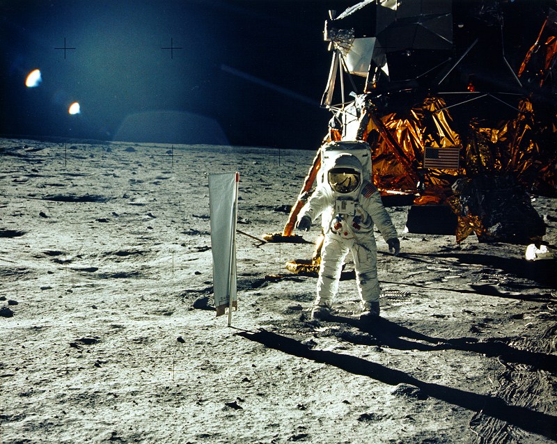
When it comes to the Moon landings, one thing hoaxers always want to see is photographs of the landing sites. Unfortunately, it’s not as easy as turning a telescope to the Moon and taking a picture of the lunar module’s descent stage and American flag standing nearby. But we can see the remains of the landing sites from lunar orbit thanks to NASA’s Lunar Reconnaissance Orbiter. Not only has the spacecraft’s camera has resolved the sites in enough detail to see where the astronauts walked, we can match the images up with the maps NASA made of the astronauts’ traverses in the 1960s and 1970s.

All LRO Images from NASA. Additional images and info from the Lunar and Planetary Institute (Apollo 11, Apollo 12, Apollo 14, Apollo 15, Apollo 16, Apollo 17).

Space photo
This first landing mission was also NASA’s most conservative. Neil Armstrong and Buzz Aldrin spent about 20 hours on the Moon, just two-and-a-half hours of which they spent exploring the surface. The astronauts took a contingency sample, set up a couple of surface experiments, and did some appropriately historic activities like unveiling a plaque on the lunar lander’s leg and took a call from President Nixon.

Apollo 11’s Traverse Map

This first landing mission was also NASA’s most conservative. Neil Armstrong and Buzz Aldrin spent about 20 hours on the Moon, just two-and-a-half hours of which they spent exploring the surface. The astronauts took a contingency sample, set up a couple of surface experiments, and did some appropriately historic activities like unveiling a plaque on the lunar lander’s leg and took a call from President Nixon.
In the LRO image taken from 15 miles above the surface, we can see the remains of their footsteps on the Moon: where they walked to set up the camera, set up the surface experiments, and walked to a nearby crater.

Apollo 11 from LRO

In the LRO image taken from 15 miles above the surface, we can see the remains of their footsteps on the Moon: where they walked to set up the camera, set up the surface experiments, and walked to a nearby crater.
After Apollo 11’s successful landing, Apollo 12 was the first mission to really study the Moon in the name of science. Pete Conrad and Alan Bean explored the Ocean of Storms in November of 1969, and in addition to deploying surface experiments and gathering samples, they carried out an historic objective: they recovered pieces from 1966’s Surveyor 3 spacecraft. Conrad managed to land the Lunar Module Intrepid walking distance from the spacecraft.

Apollo 12’s Traverse Map

After Apollo 11’s successful landing, Apollo 12 was the first mission to really study the Moon in the name of science. Pete Conrad and Alan Bean explored the Ocean of Storms in November of 1969, and in addition to deploying surface experiments and gathering samples, they carried out an historic objective: they recovered pieces from 1966’s Surveyor 3 spacecraft. Conrad managed to land the Lunar Module Intrepid walking distance from the spacecraft.
This LRO image shows both Apollo’s 12’s landing site and Surveyor 3’s. The dark lines crossing the surface show where the astronauts walked within a radius of 0.31 miles. They spent seven and a half hours exploring the surface.

Apollo 12 from LRO

This LRO image shows both Apollo’s 12’s landing site and Surveyor 3’s. The dark lines crossing the surface show where the astronauts walked within a radius of 0.31 miles. They spent seven and a half hours exploring the surface.
Apollo 14 landed where Apollo 13 was meant to explore: the Fra Mauro highlands. Al Shepard and Ed Mitchell performed two EVAs during their 33.5 hours on the Moon totaling more than 9 hours. Over these two EVAs covered a total traverse distance of 2.17 miles, collected samples at 13 locations, and deployed or performed 10 experiments.

Apollo 14’s Traverse Map

Apollo 14 landed where Apollo 13 was meant to explore: the Fra Mauro highlands. Al Shepard and Ed Mitchell performed two EVAs during their 33.5 hours on the Moon totaling more than 9 hours. Over these two EVAs covered a total traverse distance of 2.17 miles, collected samples at 13 locations, and deployed or performed 10 experiments.
NASA’s LRO spacecraft has photographed the Apollo 14 landing site multiple times, each time with the Sun at a slightly different angle to reveal more details about the astronauts’ EVAs. This image shows that the astronauts strayed as far as 1,640 feet from the lunar module Antares.

Apollo 14 from LRO

NASA’s LRO spacecraft has photographed the Apollo 14 landing site multiple times, each time with the Sun at a slightly different angle to reveal more details about the astronauts’ EVAs. This image shows that the astronauts strayed as far as 1,640 feet from the lunar module Antares.
Apollo 15’s explored the Hadley-Apennine landing site with the first lunar module. This meant that during the crew’s 67 hours on the Moon, Dave Scott and Jim Irwin performed three EVAs totaling about 18.5 hours covering nearly 17.3 miles. The crew collected samples at 12 locations, deployed 10 experiments, and extensively photographed the lunar surface.

Apollo 15’s Traverse Map

Apollo 15’s explored the Hadley-Apennine landing site with the first lunar module. This meant that during the crew’s 67 hours on the Moon, Dave Scott and Jim Irwin performed three EVAs totaling about 18.5 hours covering nearly 17.3 miles. The crew collected samples at 12 locations, deployed 10 experiments, and extensively photographed the lunar surface.
The LRO images of Apollo 15’s landing site shows the first lunar rover tracks on the Moon, and shows where the crew left that first car to drive on the Moon.

Apollo 15 from LRO

The LRO images of Apollo 15’s landing site shows the first lunar rover tracks on the Moon, and shows where the crew left that first car to drive on the Moon.
During their 71 hours on the Moon, Apollo 16’s John Young and Charlie Duke crew conducted three EVAs totaling a little more than 20 hours. They also had a lunar rover, aiding their traverse which totaled 16.6 miles. The crew collected samples from 11 sites, deployed or performed nine experiments, photographed the surface.

Apollo 16’s Traverse Map

During their 71 hours on the Moon, Apollo 16’s John Young and Charlie Duke crew conducted three EVAs totaling a little more than 20 hours. They also had a lunar rover, aiding their traverse which totaled 16.6 miles. The crew collected samples from 11 sites, deployed or performed nine experiments, photographed the surface.
The LRO images shows the Lunar Module Orion’s descent stage still in the Descartes Highlands. To the right is the lunar rover’s parking spot. The faint dark lines are where the crew walked to set up experiments and gather samples.

Apollo 16 from LRO

The LRO images shows the Lunar Module Orion’s descent stage still in the Descartes Highlands. To the right is the lunar rover’s parking spot. The faint dark lines are where the crew walked to set up experiments and gather samples.
The final lunar landing mission was also the most extensive. Gene Cernan and Jack Schmitt performed three EVAs during their 75 hours on the Moon’s Taurus-Littrow region totaling 22 hours and 3 minutes. With the lunar rover, the crew covered a total distance of 22.21 miles.

Apollo 17’s Traverse Map

The final lunar landing mission was also the most extensive. Gene Cernan and Jack Schmitt performed three EVAs during their 75 hours on the Moon’s Taurus-Littrow region totaling 22 hours and 3 minutes. With the lunar rover, the crew covered a total distance of 22.21 miles.
The lunar module Challenger’s descent stage is visible in this LRO image, as is the placement of the ALSEP (Apollo Lunar Surface Experiment Package), the flag, and the rover’s final parking spot.

Apollo 17 from LRO

The lunar module Challenger’s descent stage is visible in this LRO image, as is the placement of the ALSEP (Apollo Lunar Surface Experiment Package), the flag, and the rover’s final parking spot.