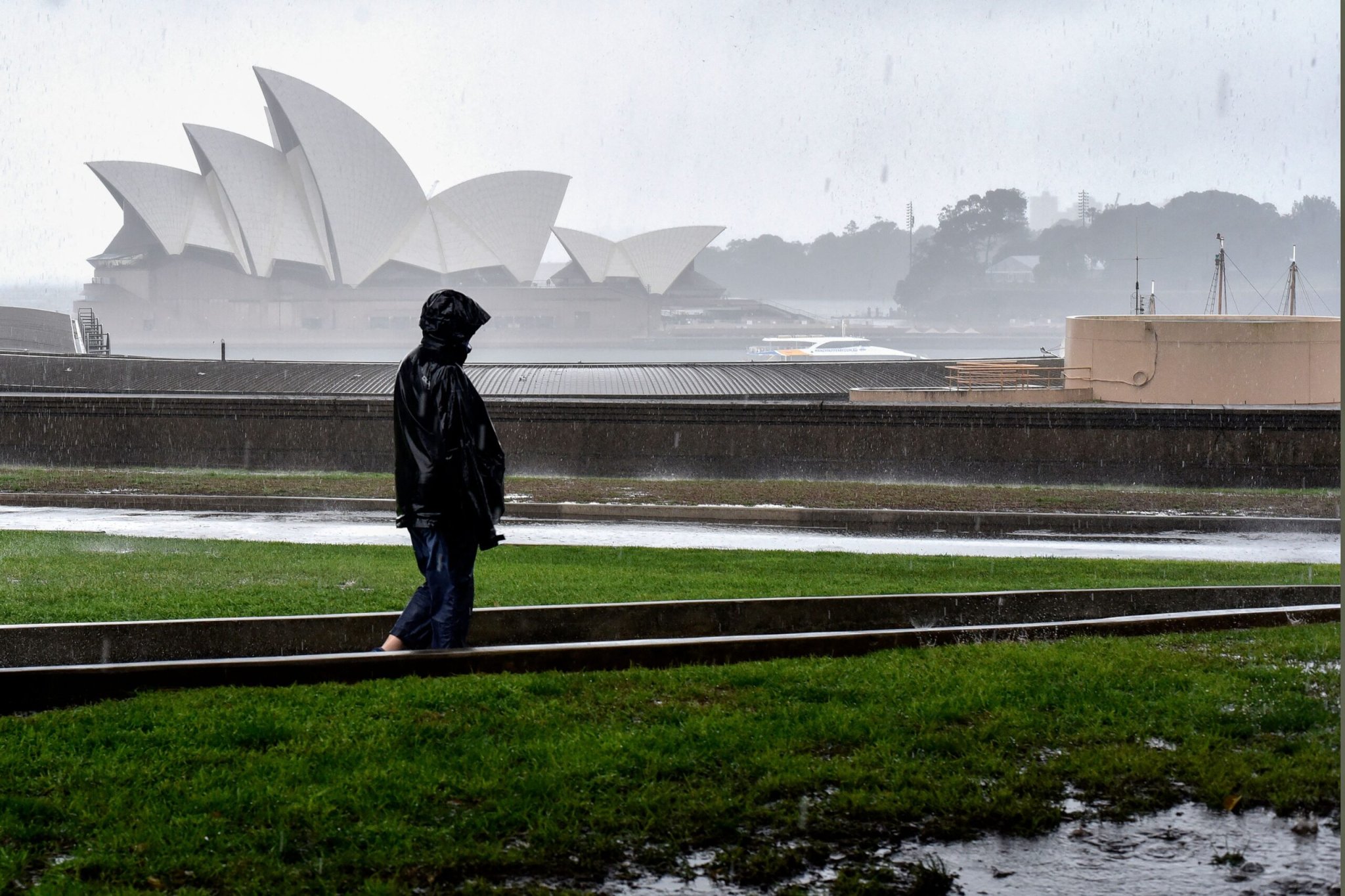
Yesterday, Australia’s largest city Sydney beat an annual rainfall record set in 1950 of 86.4 inches (2,194 millimeters). In the first nine months of the year, the area has already seen about 175 percent of the average annual rainfall, according to CNN Meteorologists.
Between early morning and early afternoon 1.07 inches had fallen at Sydney’s Observatory Hill rain gauge. According to Australia’s Bureau of Meteorology, the records at the rain gauge on Observatory Hill date back to 1859.
Sydney and the rest of New South Wales is seeing swollen rivers and moderate-to-major flooding due to the deluge that began on Thursday. More heavy rain is expected to continue across the city and other parts of southeastern Australia, peaking sometime on Saturday.
Earlier this year, Sydney broke a 1942 record for wettest March recorded when 21.8 inches of rain fell. July 2022 was also the rainiest July on record after only two weeks. The month saw 15.9 inches, beating the old 1950 record by about 2 inches.
[Related: Why floods in mountainous regions are getting worse.]
In September, the Australian Bureau of Meteorology declared that a La Niña weather pattern was underway in the Pacific. This type of weather pattern is typically associated with above-average rainfall in eastern Australia. This year is also a rare triple dip La Niña, and meteorologists forecast that the conditions will peak during the Southern Hemisphere’s spring (fall in the United States and the Northern Hemisphere).
La Niña is a natural and cyclical cooling of ocean surface temperatures in the central and eastern equatorial Pacific Ocean. The cooling is coupled with changes in the tropical atmospheric circulation, particularly winds, barometric pressure, and rainfall. This cooling doesn’t mean that global-warming is letting up. During La Niña events, trade winds are typically stronger than usual, pushing more warm water toward Asia.
Upwelling increases off the western coast of America, which brings cold, nutrient-rich water up to the surface. The colder surface waters in the Pacific Ocean push the jet stream north, which tends to lead to drought conditions in the southern part of the United States and heavy rains and flooding in the Pacific Northwest and Canada. Winter temperatures are warmer than normal in the South and cooler than normal in the North during a La Niña year, and the weather event can also lead to a more severe hurricane season.
[Related: What is a flash flood?]
El Niño has the opposite effect on global weather patterns: the trade winds weaken and warm water is pushed toward the west coast of the Americas. The Pacific jet stream moves south, giving areas in the northern US and Canada dryer and warmer than usual conditions, and wetter conditions in the Southeast and Gulf Coast.
Right before this triple-dip La Niña began, Australia faced it’s hottest and driest year on record (2019). Drought fueled wildfires destroyed more than 3,000 homes, razed about 47 million acres of land, and directly or indirectly killed more than 400 people. Sydney was choked with wildfire smoke during the Southern Hemisphere summer of 2019-2020, causing increased hospitalizations for those with asthma, cancelled sports practices for kids, and taped windows to keep the smoke out of homes.
Correction (October 16, 2022): The story previously referred to Sydney as the capital city of Australia, which is actually Canberra. It has now been corrected.
