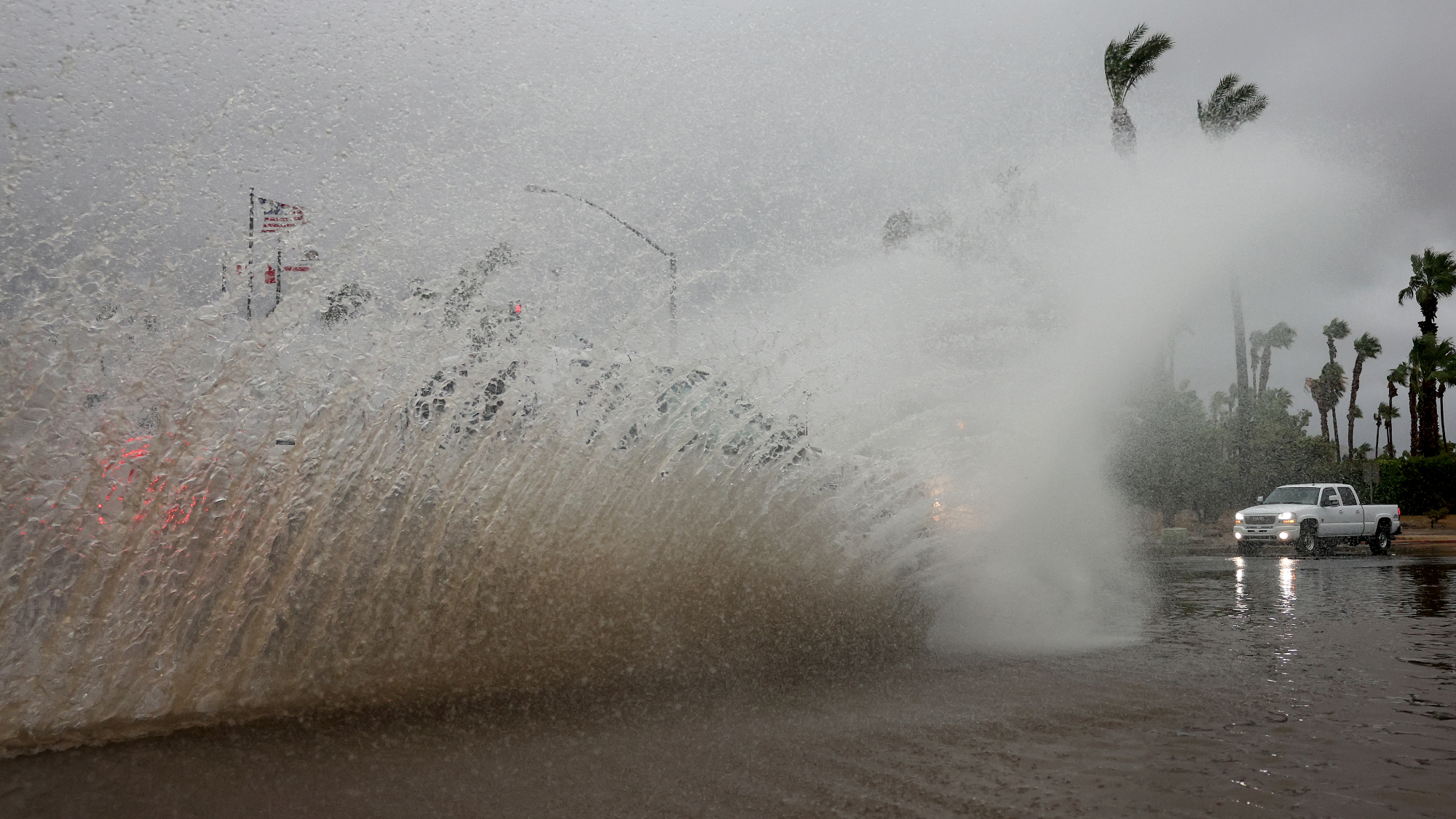
Tropical Storm Hilary drenched parts of Southern California from coastal areas to inland mountains and deserts on August 20. Hilary was the first first tropical storm to hit Southern California in 84 years, and dropped more than half of an average year’s worth of rain in some areas. Popular desert resort city Palm Springs saw nearly three inches of rain by Sunday evening and downtown Los Angeles broke a 117 year-old rainfall record with 2.48 inches of rain.
[Related: A rare tropical storm will skirt by the Southwest, just days after historic heatwave.]
The storm is now considered a post-tropical cyclone as it moves through the southwestern United States. Post-tropical cyclones no longer possess the sufficient tropical characteristics to be considered a tropical cyclone, but can continue to produce heavy rains and high winds, according to the National Hurricane Center.
As of Monday morning, Hilary has winds of roughly 35 MPH with some stronger gusts as it is moving north in central Nevada, about 390 miles north of San Diego. While all coastal tropical storm warnings have ended, flood watches remain for more than 25 million people from Southern California to northern Idaho.
The storm first made landfall on Saturday August 19 in Mexico’s Baja California Peninsula about 150 miles south of Ensenada. One person reportedly drowned Saturday in Santa Rosalia on the eastern coast of the peninsula when a vehicle was swept away in an overflowing stream.The storm then moved through Tijuana and up towards the United States.
Flooding and mudslides could continue today in Mexico and California as the storm weakens and moves towards Nevada. Unprecedented rainfall of up to 10 inches is possible across parts of Southern California and Nevada through Monday morning. Rainfall up to 5 inches is possible across parts of Oregon and Idaho through Tuesday August 22.
The power grid largely held up, as Southern California Edison reports about 13,000 customers without power as of Sunday. The Los Angeles Department of Water and Power reported roughly 3,000 customers without power Sunday evening and San Diego Gas and Electric reported less than 1,000 outages.
Sunday afternoon also brought Southern California another surprise, as an earthquake with a preliminary magnitude of 5.1 shook the region. According to the US Geological Survey, the earthquake was centered near Ojai, about 80 miles northwest of downtown Los Angeles. Smaller aftershocks were also felt, but the Ventura County Sheriff’s Office said there were no immediate reports of injury or damage.
[Related: The future of hurricanes is full of floods—a lot of them.]
In September 2022, moisture from Tropical Storm Kay moved through the Southwest, but did not hit the region. California rarely has tropical cyclones or hurricanes that make landfall due to a combination of unfavorable atmospheric conditions off the coast, prevailing east-to-west winds that push storms out to sea, and cold water that sucks the strength out of tropical systems typically keeps them away. Experts say storms like this will remain rare even as the climate changes, but that warming ocean temperatures will make the tropical storms that do make landfall stronger and more damaging.
The hurricanes that form every year in the Atlantic Ocean near the southeastern US feed off of warm waters and currents that move that water south to north. The West Coast sees the opposite, with ocean currents carrying colder water from Alaska to California.
“Very warm ocean water is essentially hurricane fuel,” Daniel Swain, a UCLA climate scientist told The Los Angeles Times. “So you generally need water temperatures getting up toward around 80 degrees or warmer on a sustained basis. The all-time record, high temperature at Scripps Pier [in San Diego] is right at 80 degrees, so we’re almost always well below this temperature threshold the ocean would be required to generate or sustain a tropical cyclone.”
