Google filled in some of Street View's gaps today, and with the addition of Antarctica, is now able to claim Street View's availability on all seven continents. Why it took Google as long to add Brazil and Ireland as it did the frigid giant ice-float that is Antarctica, we have no idea. But now you can get the real extremes, whether it's tropical heat in Brazil, subzero temperatures in Antarctica's Half Moon Island, or, um, bogs in Ireland.
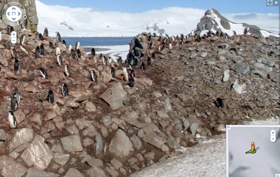
It's taken three years to get that seventh continent, but Google has finally expanded to the little-explored landmass. Right now, views are limited, for obvious reasons, but there are lots of shots from Half Moon Island, which include some great photos of penguins and seals. Antarctic coverage will be expanded both through official photography (we're hoping for a Google Street View snowmobile) and through user submissions--the latter are marked on the map as blue dots.
Brazil and Ireland are both traditionally mapped, with heavy coverage around Brazil's coastal areas and Ireland's cities. There are a surprising number of photos of Brazil's inland areas, including lots of gorgeous rainforest shots--hopefully there are lots more to come.
[Google]
Five amazing, clean technologies that will set us free, in this month's energy-focused issue. Also: how to build a better bomb detector, the robotic toys that are raising your children, a human catapult, the world's smallest arcade, and much more.


Online Content Director: Suzanne LaBarre | Email
Senior Editor: Paul Adams | Email
Associate Editor: Dan Nosowitz | Email
Assistant Editor: Colin Lecher | Email
Assistant Editor: Rose Pastore | Email
Contributing Writers:
Kelsey D. Atherton | Email
Francie Diep | Email
Shaunacy Ferro | Email
Lots of points on Antarctica with completely irrelevant photos.. wonder why
I noticed the irrelevant photos as well and decided to read a comment on one of a Wisconsin barn. Someone's best guess is that the contributor of the image reversed the latitude and longitude so instead of being in the middle of the U.S. it's much further south...
I love this Google street view, and I'm having a hard time understanding why some people/countries are against it. With it, I was able to show off some of my old stomping grounds in a city roughly 2000 miles away to some friends, who will probably never go there.
And it could be used as a great tool for tourists who would like to plan trips around town. This way, they will be able to identify landmarks as seen from their view, as opposed to a birds eye view like before.
If people are so worried about their privacy, they can always request to be blurred out of any photos taken.
i really want to know how Google gets street view images. do they literally drive around on every street snapping photos? im really astonished by this whole thing. i love it for exactly the same reason as 80sDude. so cool.
Did they move that photo van that was making photos of the cities there? I doubt it will work in Antarctica conditions. http://192-168-1-1.org/