Breakthroughs, discoveries, and DIY tips sent six days a week.
By signing up, you confirm you are 16+, will receive newsletters and promotional content and agree to our Terms of Use and acknowledge the data practices in our Privacy Policy. You may unsubscribe at any time.
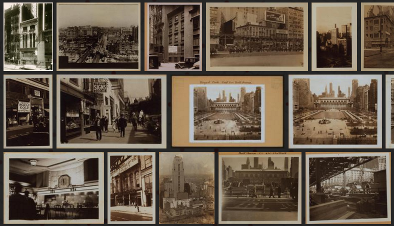
History geeks and time-travelers from the 1800s, get ready to have your days made: Old NYC combines Google Maps with photographs from the New York Public Library to create a timewarped version of Street View.
Developer Dan Vanderkam compiled over 80,000 photos from the NYPL’s “Photographic views of New York City, 1870s-1970s” collection and plotted them, using geocoding, to their corresponding origins on an interactive map of the five boroughs.
The creators of the interactive map say its goal is “to help you discover the history behind the places you see every day.” Screen shot by the authorThe Brooklyn Bridge is one of hundreds of spots on the Old NYC map NYPL