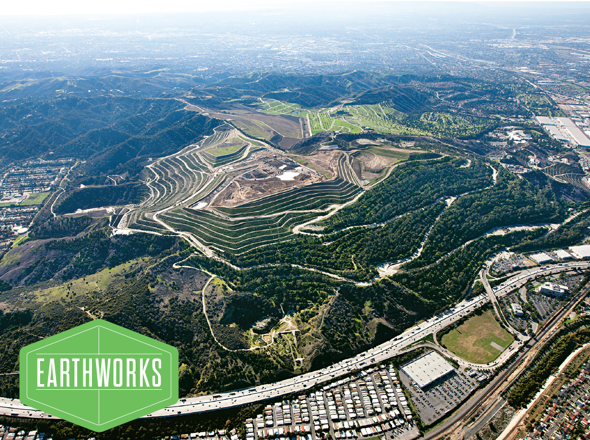
Whittier, California N 34.020261 / W 118.009300 Puente Hills is a 500-foot-tall mountain built from 130 million tons of Los Angeles County trash, given shape by garbage-moving heavy machinery and contaminant-sealing geotextiles. Before the recession, the site took in more daily trash than any other U.S. landfill. Today, visitors watch engineers sculpt each day's deliveries into a terraced landscape. Puente Hills will close its gates on October 31, when its permit expires. The sanitation department will divert trash to other nearby dumps, including the Mesquite Regional Landfill—a site whose 20,000-tons-a-day capacity should last a century. Occasional free public tours (or you can pay to dump). Courtesy the Sanitation Districts of Los Angeles County
Get the Popular Science daily newsletter💡
Breakthroughs, discoveries, and DIY tips sent every weekday.
In the past 16 months, writers Geoff Manaugh and Nicola Twilley have toured 150 of the built, natural, and virtual landscapes of the United States, collecting images and interviews. They call the project Venue, and they are documenting their progress at v-e-n-u-e.com. For Popular Science, they selected 25 of their favorite sites, each one open to the public and perfect for a late-summer road trip.
For the full list, explore the map, or click here to go through the stops one by one.
This article originally appeared in the August 2013 issue of Popular Science.
Geoff Manaugh and Nicola Twilley/v-e-n-u-e.comCourtesy Jim Sharp Photography/MevoImage.comKatie PeekGeoff Manaugh and Nicola Twilley/v-e-n-u-e.comGeoff Manaugh and Nicola Twilley/v-e-n-u-e.comGeoff Manaugh and Nicola Twilley/v-e-n-u-e.comGeoff Manaugh and Nicola Twilley/v-e-n-u-e.comCourtesy USGSGeoff Manaugh and Nicola Twilley/v-e-n-u-e.comGeoff Manaugh and Nicola Twilley/v-e-n-u-e.comCourtesy IMAM/CLUIGeoff Manaugh and Nicola Twilley/v-e-n-u-e.comGeoff Manaugh and Nicola Twilley/v-e-n-u-e.comGeoff Manaugh and Nicola Twilley/v-e-n-u-e.comGeoff Manaugh and Nicola Twilley/v-e-n-u-e.comCourtesy StratacaGeoff Manaugh and Nicola Twilley/v-e-n-u-e.comCourtesy Cahokia Mounds State Historic SiteCourtesy Center for PostNatural HistoryCourtesy Studio Matthews/The Pollinator PathwayGeoff Manaugh and Nicola Twilley/v-e-n-u-e.comGeoff Manaugh and Nicola Twilley/v-e-n-u-e.comGeoff Manaugh and Nicola Twilley/v-e-n-u-e.comCourtesy Malheur National Forest
2025 PopSci Outdoor Gift Guide
20+ editor-approved presents for the hikers on your list