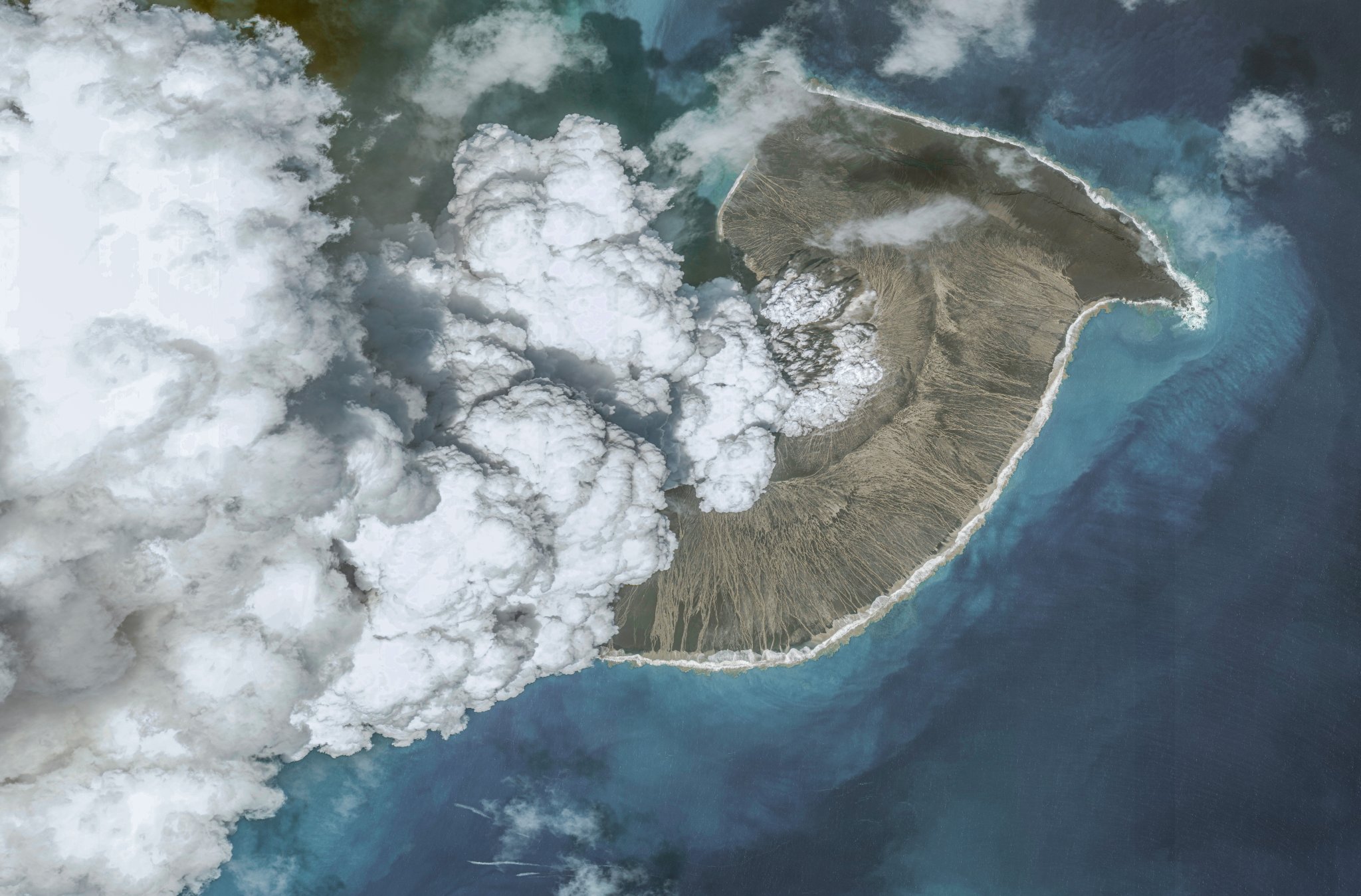
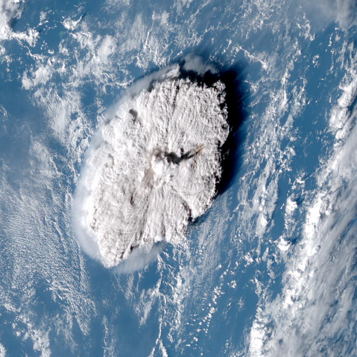
On January 15, 2022, we were once again reminded of the immense power lurking beneath the planet. On that day, Hunga Tonga–Hunga Haʻapai, a submarine volcano in the south Pacific Ocean about 40 miles north of Tonga’s main island of Tongatapu, violently erupted. After the the initial rumblings on December 20, 2021, the climax of the eruption in January pushed a huge plume of water and ash into the air, that traveled 36 miles into the Earth’s mesosphere (the atmosphere’s middle layer). It created a tsunami that reached Japan and the Americas and even severed submarine cables, cutting off Tonga’s communication with the rest of the world for a full month.
Almost one year later, researchers in the University of Oxford’s Department of Physics and RAL Space published research on satellite imagery confirming that this eruption produced the highest-ever recorded volcanic plume. It was also first to have been directly observed going into the mesosphere. The results of the study are published today in the journal Science.
[Related: Geologists: We’re not ready for volcanoes.]
“I actually come from a weather rather than volcanology background and the fact this eruption was caught so clearly by multiple weather satellites drove me to begin the study,” lead author and research fellow Simon Proud says in an interview with PopSci. “The main motivation was to test out ideas for how useful these weather sats are for examining extreme events.”
Scientists can typically estimate the height of a volcanic plume using infrared-based satellites to take the temperature recorded at the top of the plume and compare it to a vertical temperature profile. In the first and lowest layer of the Earth’s atmosphere called the troposphere, temperature decreases with height. However, if the eruption is large enough to push the plume into the next layer, (the stratosphere) this method doesn’t work as well because the temperature begins to increase again with height. This increase is due to the ozone layer absorbing solar ultraviolet radiation from the sun.
To solve this, Proud and the team used a method based on a phenomenon called the parallax effect, or the apparent difference in an object’s position when viewed from multiple lines of sight. A way to test this out is to close your right eye and hold out one hand with the thumb raised. If you then switch and close your left eye, and open the right, the thumb will appear to shift slightly. You can then calculate the distance to your thumb by measuring this apparent change in position and combining this with the known and easily measurable distance between your eyes.
[Related: Volcanic eruptions are unpredictable, but these geologists cracked the code.]
“The parallax effect is really useful for this as it doesn’t suffer from the limitations of other methods. Traditionally, we use the temperature of the plume to figure out how high it went, but that relies on an accurate knowledge of the atmospheric temperature at different altitudes, which isn’t possible during a large eruption!” says Proud. “Parallax just needs a couple of satellite images from different locations and no other info, so it’s simple and accurate.”
Three geostationary weather satellites cover the location of the volcano, so the team used the aerial images captured and apply the parallax effect to them. The satellites recorded images every 10 minutes during the eruption. This crucial data made sure that the rapid changes in the plume’s trajectory could be documented.
According to the results in the study, plume reached an altitude of 35 miles at its highest. This plume is higher than two of the the previous record-holders: Mount Pinatubo’s 1991 eruption in the Philippines (24 miles high) and the 1982 eruption of El Chichón in Mexico (19 miles high).
“The height, of course, was surprising,” says Proud. “Also, the way the height changed—we had a big peak in height that then fell away 10 minutes later, before another big peak after that. It was really surprising to see the height varying so much, so quickly.”
This plume also provides the first observational evidence of a volcanic eruption injecting material through the stratosphere and directly into the mesosphere, which is roughly 31 to 53 miles above the Earth.
Proud stressed that it is vital to continue to study these eruptions to provide better warnings and predictions of lava flows or tsunamis for those who are in harm’s way. It was also important to study if this specific eruption will be useful for climate modelers. “The climate effects of the eruption itself are quite limited, but the fact it put so much water, ash, and other debris so high into the atmosphere is a great way to test how climate models handle these situations, whether they can predict the effects,” he said.
The team’s next step is constructing an automated system that can compute the heights of volcano plumes using the parallax method. The full automation of manual calculations will speed up the process of measuring plumes.
To Proud, one thing is clear, this kind of study does not occur in a vacuum and needs expertise in multiple different areas of study to succeed.
“I think the key thing this eruption shows is how intertwined different aspects of science are now. We’re often taught in school that there’s physics, chemistry, and computing, as separate subjects,” he adds. “But they’re all so closely linked now. Our research brings together engineering, physics, math, and lots of computing.”
