
For a long stretch of human history, you had to actually go somewhere to see what it looked like. Nowadays, it’s much easier to check out the world’s sights from the comfort of your own home.
Virtual tourism tools are improving all the time, thanks in part to Google’s efforts to map all four corners of the globe. The search behemoth has Google Earth, which runs right in your web browser, but it can also help you explore more local areas with its Street View photography. Both are free, and when you know how to use them, you’ll be able to fly around the world faster than any plane.
How to use Google Earth
Google Earth has been with us for more than a decade now. Although it first launched as a desktop program, Google eventually revamped and relaunched it as a web application. It gives you a three-dimensional, interactive twist on the foundations laid by Google Maps, which makes Google Earth perfect for touring any location you like.
Getting started is easy. Once you go to the website, you have two options: You can either click the Launch Earth button to tool around yourself, or scroll down further to take a pre-made guided tour of a specific location. The latter will send you to places around the globe, where you can explore the area, check out photos, and read explanatory notes.
If you choose to dive into the main interface, simply click the search button (a magnifying glass) and type where you want to go. The search field is pretty smart, so, for example, “capital of Mongolia” will take you to the same place as “Ulaanbaatar.” If there are similarly named locations, the program will offer you a list of options to choose from.
The program’s navigation is pretty easy to use. Try out these commands:
- Click and drag to move.
- Use the mouse scroll wheel or pinch your trackpad to zoom.
- Hold down Shift, then click and drag to change the tilt level or rotate the view.
- Hold down Ctrl and click and drag to change the viewing angle.
- Click the buttons down in the lower right corner of the interface to control the zoom level and switch between 2D and 3D views
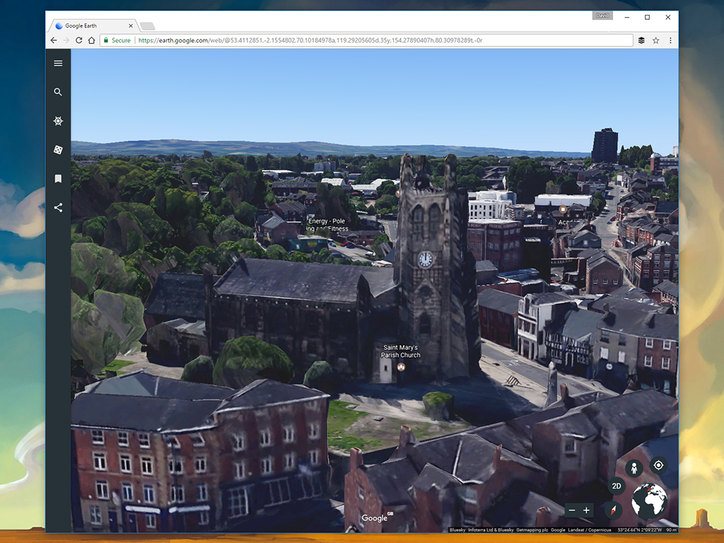
When you zoom into the highest level of detail, you can see just how comprehensive Google Earth’s 3D modeling has become, especially in urban areas. As on Google Maps, click on any of the names to learn more about that place or landmark.
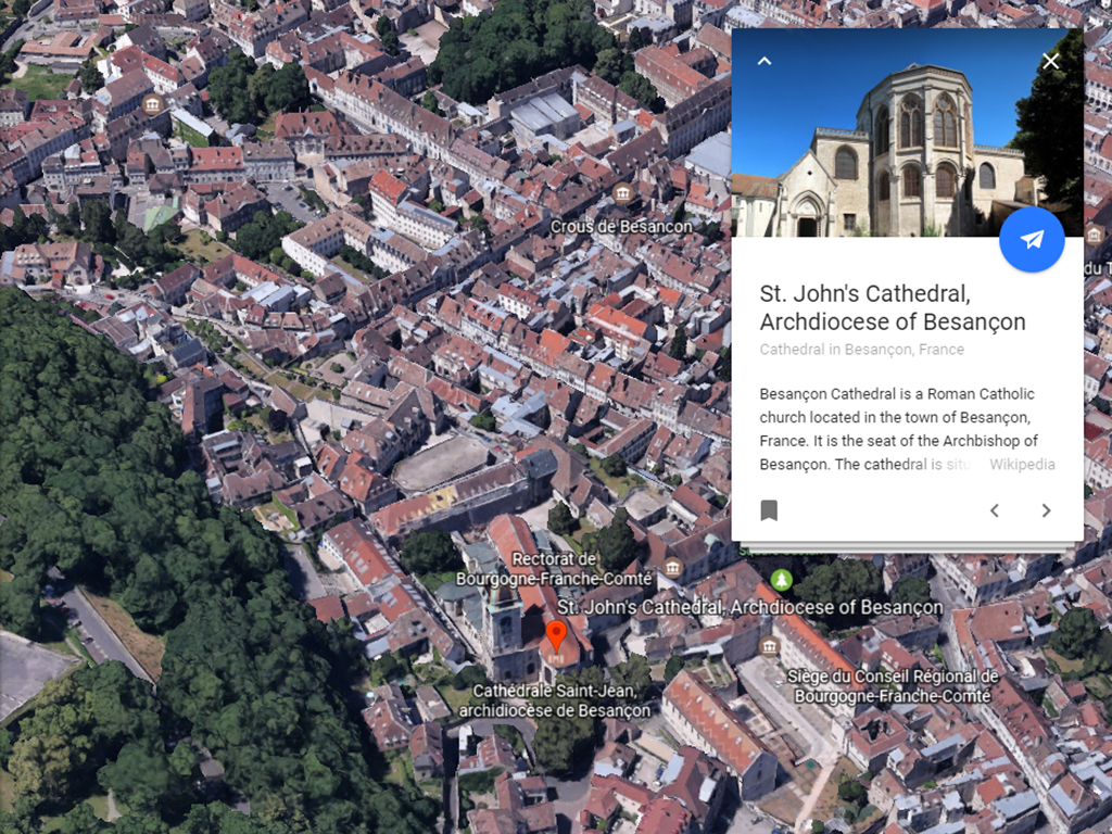
In addition to navigation, you have other menu options. Use the top-left hamburger button to open up the menu, where you’ll see the Map Style setting. This lets you customize the amount of detail you see on the screen. Other options on the menu include the Voyager tours—the pre-made packages we mentioned earlier—and places you’ve bookmarked for later reference. Every time a place card appears on screen, whether from a search or a click on the map, you can bookmark it using the Add to project button at the foot of the card.
Another feature we want to flag is the I’m Feeling Lucky option: the die icon on the left-hand sidebar. Click it to be transported to a location on the globe chosen by Google. The destination will usually be an area of natural beauty or particular interest. This is a great way to discover new places.
As well as using the web interface, you can also download Google Earth for Android or iOS. The phone apps are similar to the web interface, though you must use your fingers to navigate rather than a mouse. You can still search for, tour around, and bookmark specific locations, or choose I’m Feeling Lucky to jump somewhere new.
How to use Street View

Google Earth is fantastic for getting an overview of a place or checking out topography on a wide scale, but Street View is better for taking a really close look at neighborhoods. Built right into Google Maps and Google Earth, Street View is what most people are familiar with. To find somewhere specific, search for it in Google Maps or Google Earth, then drag the little Pegman icon from the lower-right corner to that spot.
Blue areas on the map mark streets and places of interest where Street View imagery is available. So, once you’ve reached your destination, click and drag to look around. The arrows or blue lines on screen are there to help you navigate while in Street View, so you can take a tour without leaving the ground. You can also tap the cursor keys on your keyboard to move about.
If you don’t want to go through Google Maps, Street View actually has its own portal online, where you can find some of the best photography of locations around the world. The Street View cameras have traveled along footpaths, beside railway lines, down ski runs, and up mountain faces. Now that’s dedication
Street View in Google Maps has one added bonus: historical imagery. Click Street View link with a clock icon in the top-left corner while in Street View to see if older pictures are available. In a lot of places, you can go back ten years or more, to the very earliest Street View snapshots.
As with Google Earth, you can find Street View apps for Android and iOS. They let you take a virtual walk around any location you like on your smartphone screen. One advantage of installing the phone apps is that you can create your own 360-degree images and upload them to Street View. Try photographing your street or adding a particularly beautiful spot in the countryside.
