Hundreds of years before Google Maps and other apps like it made navigation as easy as looking at your smartphone, explorers found their way around the planet by the light of the moon and stars, or by shadows cast by the sun. Today, humans rely on electronic devices, not their instincts or the study of celestial bodies. And of course before the smartphone came along, people also used maps printed on dead trees. But kids born recently aren’t using paper maps at all; instead they just punch in an address to receive a route to get where they’re going.
Off-roading champion Emily Miller wanted to teach others what she learned from years of navigating with a ruler, pencil, compass, and topographical map. With that in mind, she created the Rebelle Rally, the longest off-road time-distance navigational rally in the United States. The idea of a navigational rally might not be novel, but this one is: All competitors are required to disable any digital navigational aids on their vehicle and seal up their electronic devices (mobile phones, AirTags, tablets, laptops, and more) for the duration. It’s a test of driving precision and navigation skills, not a speed race pell-mell across the desert.
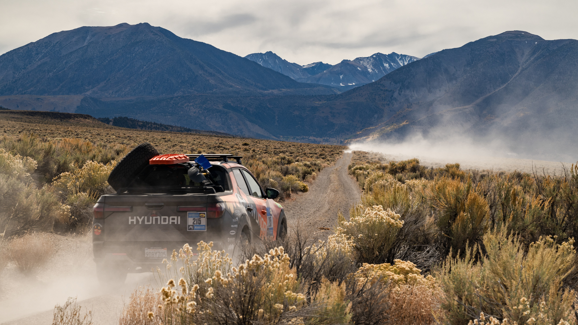
Over eight days, Rebelle Rally competitors are shut off from the world, sleeping in tents near ghost towns and rock faces instead of hotels and cities. This year, the rally’s course started in Mammoth Lakes, California, crossed into Nevada, and finished in the southeast corner of California at the majestic Glamis Dunes. The only news participants hear is their daily standings in the competition—there’s no endless scrolling of social media feeds. Plotting latitude and longitude points requires one’s full attention, and by the end of a 10-hour day spent hunting checkpoints, there’s no need for entertainment. The competitors are wiped out physically and mentally, heading for their tents to sleep.
I just completed my second year of the rally; I was sponsored by Hyundai and we operated a Santa Cruz with a 1.5-inch lift in the front and a 1-inch lift in the back. We had off-road accessories (traction boards, shovels, and a spare tire) mounted to a custom Rally Innovations rack to help us along. This is what it’s like to compete at this crossroads of analog and high-tech.

Analog navigation
Now entering its ninth year, the Rebelle Rally just wrapped up its most recent competition with 65 teams of two women each; the all-female event concluded on October 20. Each morning, the teams were alerted that it’s time to get going by the gentle clanging sound of a cowbell at 5 a.m. Many teams are already up by that point, the sounds of tent zippers tearing the fabric of the silence even before that.
Each day, a race official distributes a list of 20 or more checkpoints to the teams long before dawn. Then teams plot latitude and longitude points along with distances and headings on their paper maps. On-the-ground checkpoints are marked with flags (mandatory green checkpoints, the easiest), or poles (blue checkpoints, which are more difficult to find) or invisible geofenced areas (black checkpoints, requiring precision within 200-300 meters to avoid a penalty).
Once a team drives to the checkpoint and sees the flag, or sees what they believe to be the spot, one of the competitors clicks on a satellite tracker that displays the exact latitude and longitude point where the signal is traced. A company called YB Tracking and the Iridium satellite network track the competitors to keep them safe; the staff knows exactly where each car is, even if the teams themselves are lost.
Teams also participate in enduro segments, which are a series of checkpoints that include time checks along the route and require intense focus and concentration to stay at the average dictated speed, which may change frequently. To prepare for these on-time sections, competitors use mathematical formulas to calculate the seconds and minutes of each segment in the precise roadbook based on the distance and speed.
Using a solar-powered calculator and a basic stopwatch, we found our way.

Green power takes the gold
After seven days of full-time driving plus the half-day prologue, it was a team called the Limestone Legends that took first place in a Rivian R1T all-electric pickup truck. Not only was it the first time an all-electric vehicle earned the gold medal in the Rebelle Rally, the second place vehicle was a hybrid: a Jeep Wrangler 4xe. Rivian has been a strong supporter of the Rebelle Rally starting in October 2020 with a pre-production model of an R1T, which became the first fully electric truck to ever compete in the event.
Charging up an EV in the middle of the desert is a challenge. While gas-powered cars are fueled up by a tanker that travels from base camp to base camp with the rally, it’s not as easy to provide a boost for batteries that way. So, the Rebelle Rally partnered with Renewable Innovations to provide hydrogen-powered EV charging to the Rivian and Jeep 4xe models each day.
Each base camp embraced green energy too, mobilizing a 53-foot mobile Renewable Innovations semi with high-density solar panels combined with “follow-the-sun” smart flowers on each side to collectively deliver 50 kilowatts of peak power for base camp.
While our phones and navigation systems were unavailable by design, my team did have a Nextbase dash cam in the car so we could capture the beauty of the off-road trails in California and Nevada. It came in handy when we witnessed a crash—a Mitsubishi crossover tried to pass us and the full-size SUV in front of us on the left. We handed over our camera’s memory card to the police, providing an airtight record of what happened. And luckily, no one was seriously hurt.
