
A forest can take many different shapes: prickly with oak undergrowth, dim and mossy, or sunlit and full of soft grass. Those structures affect the animals that live there, the amount of carbon the ecosystem can store, and how a wildfire will move through the landscape. But unless a casual hiker knows what to look for, it can be hard to notice those landscape-scale patterns.
A set of remarkable LIDAR scans of Yosemite National Park in California, published by forest ecologists at the University of Washington and the remote imaging company NV5 Geospatial in EOS this month, offers a glimpse into the subtle distinctions in forests—and the huge consequences for wildfire–across an area of 100 square miles.
[Related: The American West is primed for a summer of fire]
The project started as part of the US Geological Survey’s 3D Elevation Program, which creates topographic maps of landscapes all over the country. NV5 gathers elevation data for those maps by flying a plane back and forth over Yosemite, and casting a laser over the terrain below. By measuring the time it takes the laser to bounce back to the plane, the technology, called LIDAR, can map out the surface in fine detail, even detecting individual trees.
To make a topographical map, NV5 just needs to figure out where the laser made it to the ground under the trees. But the LIDAR also captures precise detail on the trees and undergrowth above the ground. “[Light] keeps going down through the canopy—some of it gets reflected, and some of it keeps going until it hits the ground,” says Andrew Brenner, a program director with NV5.

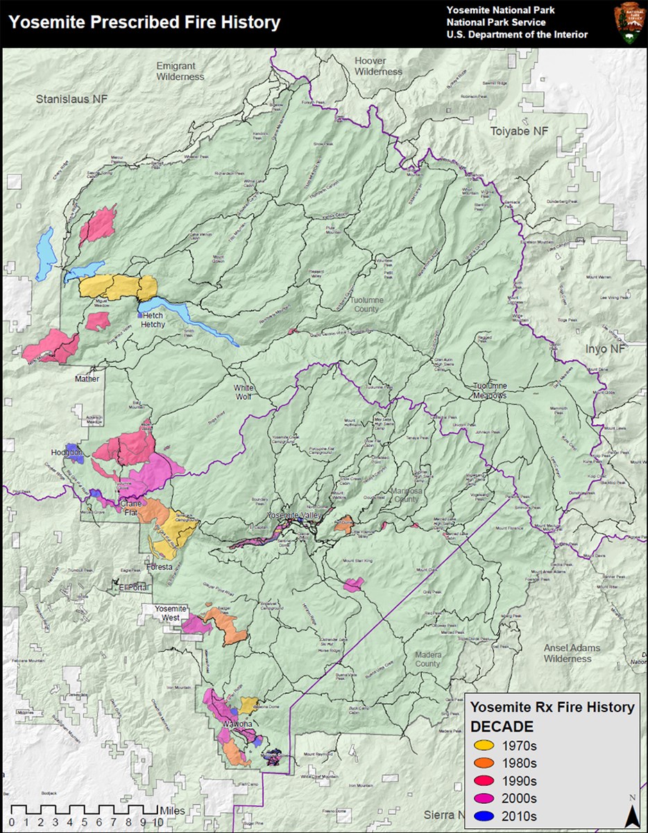
Using scans of Yosemite taken between 2010 and 2019, forest ecologists at the University of Washington were able to map how fires change the fabric of a landscape.
Before the wholesale adoption of fire suppression by the US Forest Service in the early 1900s, most North American landscapes burned regularly, including much of Yosemite. And ecologists now know that forests that burn look very different from those that don’t. In the mixed pine and fir ecosystem that covers most of Yosemite, repeated fires once thinned out small trees, creating a patchwork of clumps of mature forest and open meadow.


Those “natural firebreaks” in a patchwork forest mean that fires will usually be less intense: They’ll race through the grass and underbrush rather than “torching” whole stands of trees. That reduces fire danger for humans, but it can also benefit local ecosystems by creating habitat for sun-loving wildflowers, edible plants, and birds.
The open structure was “key to forests thriving in a regime of frequent fires,” the authors write in EOS. “However, fire suppression over many decades allowed trees to fill in the openings, creating dense stands prone to intense fires.”

Intense fires, fueled by thick forest and drought-stressed trees, can set off an ecological cascade. They can scorch soils and incinerate seedlings, making it hard for the forest to recover as it would from a milder burn. Across the West, forested landscapes are transitioning to open grasslands in the wake of fires.
Over the last 50 years, however, Yosemite’s forest managers have attempted to reintroduce regular fires, both by setting prescribed burns and leaving room for lightning-ignited blazes. But it takes time to undo decades of fire suppression, especially as climate change makes it harder to find the Goldilocks zone of healthy, moderate burning.
In areas of the national park where fires were regular, the researchers found that the forests had opened up—and were better able to survive the 2013 Rim Fire, which burned hundreds of thousands of acres. But surprisingly, they saw that even a single, low- to medium-intensity fire could leave a forest looking a lot like one with regular burns.
That means that even as the climate warms and Western forests dry out, one well-timed prescribed fire could go a long way toward making a landscape more resilient.
