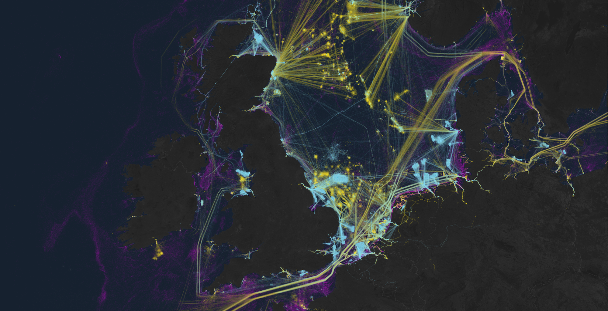
Researchers can now access artificial intelligence analysis of global satellite imagery archives for an unprecedented look at humanity’s impact and relationship to our oceans. Led by Global Fishing Watch, a Google-backed nonprofit focused on monitoring maritime industries, the open source project is detailed in a study published January 3 in Nature. It showcases never-before-mapped industrial effects on aquatic ecosystems thanks to recent advancements in machine learning technology.
The new research shines a light on “dark fleets,” a term often referring to the large segment of maritime vessels that do not broadcast their locations. According to Global Fishing Watch’s Wednesday announcement, as much as 75 percent of all industrial fishing vessels “are hidden from public view.”
As The Verge explains, maritime watchdogs have long relied on the Automatic Identification System (AIS) to track vessels’ radio activity across the globe—all the while knowing the tool was far from perfect. AIS requirements differ between countries and vessels, and it’s easy to simply turn off a ship’s transponder when a crew wants to stay off the grid. Hence the (previously murky) realm of dark fleets.

“On land, we have detailed maps of almost every road and building on the planet. In contrast, growth in our ocean has been largely hidden from public view,” David Kroodsma, the nonprofit’s director of research and innovation, said in an official statement on January 3. “This study helps eliminate the blindspots and shed light on the breadth and intensity of human activity at sea.”
[Related: How to build offshore wind farms in harmony with nature.]
To solve this data void, researchers first collected 2 million gigabytes of global imaging data taken by the European Space Agency’s Sentinel-1 satellite constellation between 2017 and 2021. Unlike AIS limitations, the ESA satellite array’s sensitive radar technology allows it to detect surface activity or movement, regardless of cloud coverage or time of day.
From there, the team combined this information with GPS data to highlight otherwise undetected or overlooked ships. A machine learning program then analyzed the massive information sets to pinpoint previously undocumented fishing vessels.
The newest findings upend previous industry assumptions, and showcase the troublingly larger impact of dark fleets around the world.
“Publicly available data wrongly suggests that Asia and Europe have similar amounts of fishing within their borders, but our mapping reveals that Asia dominates—for every 10 fishing vessels we found on the water, seven were in Asia while only one was in Europe,” Jennifer Raynor, a study co-author and University of Wisconsin-Madison assistant professor of natural resource economics, said in the announcement. “By revealing dark vessels, we have created the most comprehensive public picture of global industrial fishing available.”
It’s not all troubling revisions, however. According to the team’s findings, the number of green offshore energy projects more than doubled over the five-year timespan analyzed. As of 2021, wind turbines officially outnumbered the world’s oil platforms, with China taking the lead by increasing its number of wind farms by 900 percent.
“Previously, this type of satellite monitoring was only available to those who could pay for it. Now it is freely available to all nations,” Kroodsma said in Wednesday’s announcement, declaring the study as marking “the beginning of a new era in ocean management and transparency.”
