The snow hasn’t started yet this October evening in Boulder, Colorado, but the sharp wind and low clouds around Backcountry Pizza & Tap House foretell an early winter storm. Just before 6 p.m., Diane Fritz comes in from the cold, passing pinball machines and pool tables on her way to the back room. Setting down her bag, she takes off her down jacket and quickly orders an IPA before happy hour ends. “Lots of people probably won’t make it,” she says, guessing they’ll be reluctant to brave frozen roads. She shrugs and pulls out her Mac bearing a sticker that reads: “Map Porn.”
Fritz works for Auraria Library in Denver, assisting people who want to incorporate spatial information into their research. If a student were doing a project about energy, for example, she’d show them how to include the location of every oil well in the state. Outside of her job, Fritz also helps lead a MeetUp group—gathering here tonight—that’s merging data about buildings into a crowdsourced map of the area. The project could eventually help emergency services reach people more rapidly, make small businesses more visible, and show residents how their city (one of the fastest growing in the nation) is changing. About 40 people have volunteered so far.
Fritz flips open her laptop to find the how-to presentation she’ll give to any newcomers who venture in. For now, though, her only audience hangs above her: beer signs scattered around the room.
As her computer powers up, the other MeetUp leader, data scientist Margaret Spyker, arrives with member Jim McAndrew, who moved to Pennsylvania and is back for a visit. “If you order quick, you’ll make happy hour,” Fritz urges them.
Spyker grabs a menu from the table, the pair orders with just two minutes to spare, and the triad begins chatting. “Jimmy’s already checked in here on Foursquare,” Spyker says.
McAndrew smiles and shrugs: guilty. Speaking of, Fritz remembers, she’s been meaning to compliment him on a recent sprint on the fitness app Strava, where he tracks his impressively fast runs.
They pause and laugh at their predictability. Even their small talk is geospatial—all about things related to place and time—exactly as you’d expect from people who build maps in their spare hours.
Tonight, they hope to make progress on the so-called Denver Building Import. They’ll overlay shapes, sizes, and addresses from a government database onto a crowdsourced, free map of the world, and merge the two so that the structures become a permanent feature of the digital geography.
The project is part of an international effort called OpenStreetMap, founded in 2004. A cartographic Wikipedia, OSM relies on volunteers—a million since its start, making it the largest such endeavor—to create an ever-evolving representation of the planet. You can view it in a browser or within a platform like Facebook, which relies on it for location information. And although individuals work on it just for fun, it underpins services at huge companies like Amazon and Microsoft. OSM is important and different from maps like Google’s because it’s made by and for the people. It contains information its participants want—not, as McAndrew puts it, “what will make Google Maps money.”

The data from satellites sent up by government agencies like NASA and the European Space Agency is often public. European Space Agency
All over, nerdy normals are using mappy data for specific pursuits: Archaeologists have uncovered hidden tombs; police have found missing people; relief organizations have dispatched aid to flood victims; retired spies have located weapons caches; conservationists have detected deforestation; artists have pinpointed secret military installations; and retailers have gauged vacancies in competitors’ parking lots.
A policy adviser and analyst named Josef Koller believes this plethora of frequently updated information might lead to a tipping point he dubs the Geoint Singularity: a time when people with no particular expertise or wealth have access to geospatial data and its interpretation in real time, providing the power to investigate any place as it is right now. In effect, anyone could find a live view of whatever spot on the planet they wanted to see. “The world basically becomes transparent,” says Koller, a systems director at the Aerospace Corporation, a federally funded research and development center in Southern California.
Koller has been monitoring the space industry since around 2015, taking note as satellites became easier and cheaper to build and launch. Today, more than 700 orbiting objects watch Earth all the time, up from 192 in 2014. That growth means that some continuously produce images, showing your house not as it looked in 2016 but as it looks while you read this. He has also seen artificial intelligence getting smarter. It can, using finely tuned algorithms, count cars and identify cats or your cousin. Finally, he’s seen that with phones and fast networks, people can stream such analyses. Take that to its logical endpoint, and—voilà!—a Geoint Singularity.
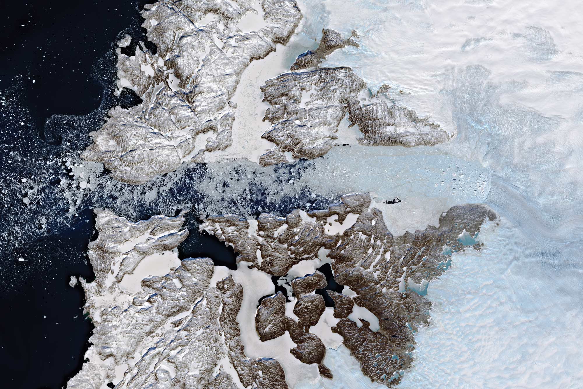
We’re not there yet, but we’re well on our way: Satellites capture images of a given sea or skyscraper daily. AI is good at narrow, specific tasks, like recognizing trees or gauging traffic, but integrating different streams—aerial pictures, CCTV feeds, Twitter threads, addresses, current trash-truck locations—remains a wicked problem. Given all that, no one can say if this singularity will come, or how, exactly, regular earthlings’ experiences would change if it did. Maybe people will watch the ice caps melt minute by minute. Maybe they will fact-check municipal claims about building new housing, or whether foreign ships are docking nearby. Maybe they will know, at all times, the best open parking space in the whole city. Or maybe they won’t care very much at all, and mapping skills will remain important but niche, deployed mostly by intelligence agencies, humanitarian groups, and corporations.
At Backcountry, the OpenStreetMap volunteers represent a future in which people do care. They want to know all about their place on the globe. McAndrew pulls up a video on his computer and puts it on loop to set the mood. A dark globe appears on the screen. Bright dots and lines flash across its surface in a DayGlo seizure, tracing countries and cities and the spaces between. It’s an atlas of Earth, drawn chronologically as people add roads, houses, and schools. Other crowdsourced projects serve specific niches; StoryMap lets users highlight the locations in a series of events; Ushahidi helps people share information about things like police encounters. But OpenStreetMap has the broadest ambitions: to capture the entire, always changing planet, and whatever people in each place care about.
McAndrew says, “Every line you see is an edit”—a place now on the map, now truer to the real world.

Around the world people have been inspired by satellite imagery. Teachers send kids on global scavenger hunts. European Space Agency
Koller named the Geoint Singularity the way you might name an unbuilt city for which you hadn’t drawn blueprints yet. While the future it represents still seems far off, the technology to achieve it has been developing for decades. The US government launched its first picture-taking satellites in the 1960s, and followed with ones dedicated to military and intelligence needs. Entities like NASA, the National Oceanic and Atmospheric Administration, and the United States Geological Survey sent up craft for scientific use. Their data is largely public, giving access to decades-old records that anyone can compare with today’s.
In the 1990s, business joined in, largely so it could sell pictures to spooky agencies. WorldView Imaging Corporation, now called Maxar, deployed the first privately owned cameras to peer down at Earth. Today the company also sells data to oil and gas companies to monitor pipelines, to mega-retailers to keep an eye on store traffic, and to developers to survey potential construction zones.
In the meantime, a virtual panopticon has emerged, one that no longer just takes pictures. Satellites also nab radio transmissions, weather information, infrared images, and radar data. Drones overfly the planet, street cameras keep watch closer to the ground, smart devices broadcast locations, and governmental datasets—from curb cuts to county lines—live online. With each uptick in detail, the singularity draws closer.
It can only happen, though, if data reaches the public—not exactly the strong suit of private companies. Still, they do sometimes share. Maxar, for instance, ran the first major effort to involve laypeople in image analysis and mapmaking. Called Tomnod, the nine-year program enlisted amateurs during disasters, like the Malaysia Airlines crash in 2014, or for scientific research, such as counting Weddell seals in Antarctica for a 2016 census. During crises, Maxar also makes imagery available to groups like Humanitarian OpenStreetMap, which sponsors crowdsourced efforts to plot crisis-plagued regions—say, after earthquakes, or to chart vaccine distribution, or understand refugee migration.
Companies also occasionally give their data to scientists who are studying climate change, journalists reporting on hard-to-reach places, and analysts trying to suss out global tensions. One of those is David Schmerler, who researches nuclear-weapon and missile developments at the Middlebury Institute of International Studies at Monterey in California.
Schmerler doesn’t really have formal training in satellite-image analysis, but with his morning coffee in hand, he logs on to the website of a company called Planet, which operates around 140 satellites that take pictures of all the land on Earth every day. Some groups use the data to track deforestation, or calculate how many cargo ships reached a given port on Tuesday. But, as the caffeine hits, Schmerler zooms in on a few sites in North Korea. “If I see a lot of road activity, or if a building blows up, or they changed the roof, something is happening there,” he says. In the old days, you would learn of such things only days or months later, when an overscheduled satellite got around to taking a look. Today, you can see it today.
Schmerler sees all this geospatial data as a path to truth in a twisty world. “You can verify all sorts of claims using satellite imagery,” he points out. And when he says “you,” he means it. “When someone says something is changing in the world, we don’t have to rely on that statement. If someone says the ice caps are melting, you can log on and see that happen.”
Colorado is a geospatial hub of sorts: It’s home to Maxar, NOAA offices, and a cluster of younger satellite startups, all of them full of people whose geo-knowledge base is generally better than average. Geospatial Amateurs, based in the Denver metro area, is another MeetUp that believes in the personal utility of all this data. “Amateurs” is a cheeky name. Many members, some of whom are also part of OSM, work in fields at least somewhat related to mapping or Earth observation, like environmental science or transportation. They don’t want sponsorships or corporate meddling or professional influence. Instead, the group wants to foster what leader Brian Timoney calls “roll your own” projects. It’s DIY, but with images, sensor readings, and maps instead of needle, thread, and aida cloth. “The idea,” he says, “is you can answer geospatial questions that impact your everyday life.”
To keep the club more approachable, Timoney—a data analyst who runs a consulting firm—has tried to create a low-key vibe, starting with the MeetUp descriptions themselves. Take the invitation to the August 2019 gathering: A scientist demonstrates how to use radar and laser data to calculate snow depths on whatever black-or-blue slopes the attendees personally care about. “After this presentation, you’ll be looking around your ski mountain with a subtler eye,” read the website, “while the basic chads clogging I-70 will still be taking a resort’s mid-mountain snowpack-depth reading at face value.”
At other meetings, members show-and-tell their homebrewed solutions, which use municipal datasets, open-source information from agencies like NOAA, and legal hacks of companies like the Car2Go rental service. An actual Chad made a pedestrian map of sidewalks in the Denver area. Member Adam Bickford helped a city-council candidate optimize canvassing routes. And Ricardo Oliveira took the real-time feed of bus locations and created his own display. (Those examples happened before big political campaigns and organizations built their own versions.) “We want to get the word out about the rich variety of datasets that are available,” Timoney says, “and inspire people.”
Around the world, people have been inspired, particularly by satellite imagery. Teachers send kids on global scavenger hunts. Homebodies see places they might never visit, guided by websites like Google Sightseeing (not affiliated with Google but rather with two guys). Farmers figuring out where their corn should go overlay snaps with Google Earth satellite maps. Hikers pore over them to find unmarked trails. Hunters consult them to predict where the animals will be.
If the singularity arrives, those pursuits, though, will look different: Second graders and skilled alpinists will be aware of the planet as it is—not as it was last week, last month, or last year. What if you could watch the travels of a specific herd of elk every day? What if you could tell how crowded your tourist destination was an hour ago? What if day-trippers could peep the percentage of fall-turned leaves before they set out on the road?

DIY groups hope the availability of satellite data will lead to more localized mapping projects. European Space Agency
At Backcountry Pizza, meanwhile, the mappers finally have a new arrival, someone who has never worked on this project before: Travis Burt, a developer with utility company Franklin Energy. Burt immediately pulls out his laptop to learn how to begin merging Denver building data with the OpenStreetMap grid.
While Spyker and McAndrew chat in the corner, group leader Fritz tells Burt how to register so that he can see data from the Denver Regional Council of Governments—which, according to Fritz, “we lovingly call Dr. Cog.” Every two years, Dr. Cog pays to fly picture-taking planes over the metro area. Analysts then use that imagery to trace the boundaries of buildings, accurate to around 3 inches. While all of the information is public and free, it’s not especially layperson-friendly. But once it’s in OpenStreetMap, it won’t be much harder for anyone to access and understand than Google Maps.
Pinning numbers to virtual buildings is as important as the shapes and spots on the ground. “We don’t actually know, even in our super-urban area, what the addresses are,” Spyker says. That’s a problem for 911 operators, who can’t send responders to a location if they don’t know exactly where it is. Because the Denver area is changing so rapidly, the mappers hope to keep updating the buildings, creating a historical record—a sort of pencil-mark-on-the-doorjamb growth chart—of how the city becomes what it will be. In the OSM, you can check out the archive of edits just like you can on Wikipedia.
Denver, of course, isn’t the only city lacking user-friendly data, and the problem is even more acute in rural and developing areas. Across the world, more than 150 OpenStreetMap chapters are helping to make their regions visible, tracking an ever-shifting landscape of roads and borders.
Coloring in the map can also just be fun. Spyker and Fritz are creating a city art directory, and soon they’ll be able to peg graffiti and murals to the walls of specific structures. Green thumbs could one day calculate how many hours of sunshine their building-shadowed urban gardens will get. A bookstore owner could estimate how many people will walk by their window display.
Under Fritz’s helpful tutelage, Burt finally gets to the point of actually working. He stares mirror-eyed at the map, all of its layers shining from his screen, waiting for him to paint on another. “Ah,” he says, “this looks beautiful.”
“Did you hear that?” Fritz asks Spyker, who’s pulling up a site she made to help people plan pub crawls on bikes. “He said it was beautiful.”
The MeetUp group at Backcountry Pizza tonight represents the vanguard of the Geoint Singularity. But it’s also fair to ask if a tipping point is something the average person wants, needs, or will ever care about. Consider, for instance, that most folks are content with spinning through Google Earth, where the images are usually a couple of years old. “That satisfies most people’s basic curiosity,” says Geospatial Amateurs’ Timoney.
The phenomenon’s godfather, Koller, notes that the singularity really requires a useful idea, one that cheaply and easily integrates real-time data and analysis, probably through a smartphone or browser interface. The glut of information is too much for our puny brains to parse quickly, which means we’ll also need AI to get smarter than it is now, and have the particular kind of savvy to serve up what people actually want. “The key point will be to find that killer application,” he says, a reason that an all-seeing eye on Earth would make the everyday easier or more efficient. “I don’t think anybody has really identified that yet.”
This wouldn’t be the first time we couldn’t clearly see the future. “If someone had asked me some question in 1980 about GPS, I’d be like, ‘I don’t know if it’s useful to see where you are,’” says Georgia Tech’s Mariel Borowitz, author of Open Space: The Global Effort for Open Access to Environmental Satellite Data. But here we are, with Tinder and Yelp and our general inability to navigate without a robot voice in our ear, because of GPS and our smartphones’ ability to put them in our palms.
Borowitz has questions, though, about how privacy protections will evolve. “I can imagine when you have ubiquitous data, your ability to track individuals or specific individual movements increases,” she says. The rub for watching the whole world change is that you are part of that world.
And not every “you” will get access to that change. “What I think stands in the way of closing the digital divide is the growing trend of the rich versus the poor,” Koller says. When only the wealthy can reach the bounty, they also control how information gets collected, used, and interpreted.
That’s why self-rolled initiatives aim to put power in more hands. Like, for example, the hands of people currently PayPaling their share of the pizza bill to Fritz. Only one of them—Burt—has mapped anything tonight. But that’s fine. As much as this group is about geospatial data, it’s also about connecting a community, and forging bright lines between them.
McAndrew tilts his eyes toward the window. The storm has fully arrived. He stares for a second before pulling out his phone and punching up a real-time traffic display. “You can tell where the snow’s the worst,” he says, flashing his screen toward us. Green segments, where cars are flowing, slam into red ones, where drivers have slowed, flakes undoubtedly hypnotic in their headlights.
When we step outside, our eyes confirm the situation: The snow has begun to stick. It piles up on cars and blades of grass. It reveals the outlines of everything, showing our footprints as we walk away from each other, past buildings yet to be imported.
This story appears in the Spring 2020, Origins issue of Popular Science.
