A long lost portion of the Nile may answer a mystery behind some of ancient Egypt’s most famous pyramids. According to researchers, 31 structures—including the pyramids of Giza—at one time stood near the banks of a now dry river branch, buried under sand and silt for thousands of years. If so, this could explain how builders managed to transport the monuments’ materials, as well as potentially guide researchers towards undiscovered sites in the future.
Although the roughly 40 mile stretch of Western Desert Plateau foothills is largely inhospitable terrain today, river sediment located deep underground indicates that wasn’t always the case. Eman Ghoneim and his colleagues at the University of North Carolina Wilmington believe this area was at one time a much more arable and vibrant region, particularly around 4,700 years ago when the Nile branched far more than now. This is also the era in which construction began on the area’s first pyramids.
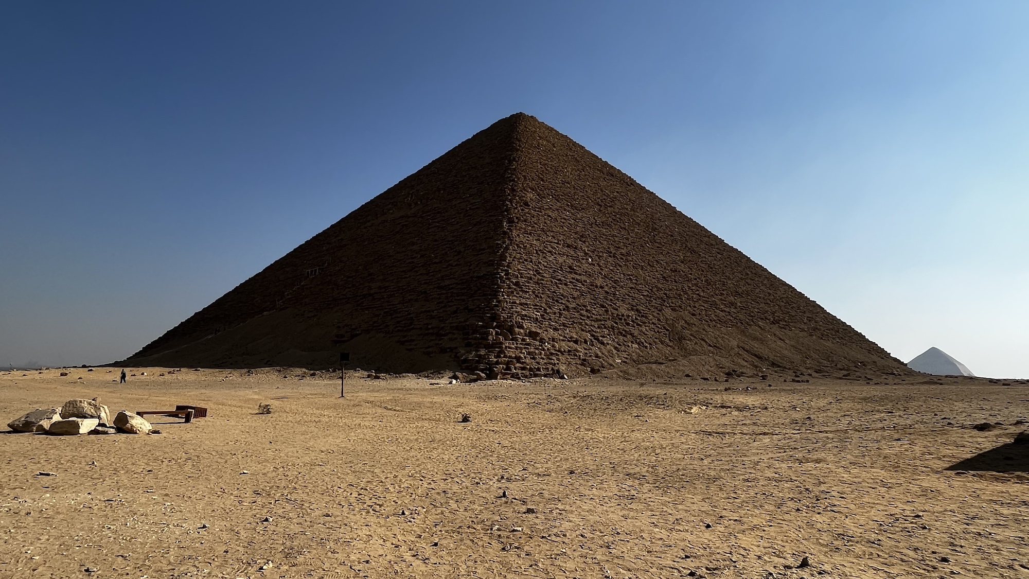
“Monumental structures, such as pyramids and temples, would logically be built near major waterways to facilitate the transportation of their construction materials and workers,” Ghoneim and his colleagues wrote in their new paper published today in Communications Earth & Environment. “Yet, no waterway has been found near the largest pyramid field in Egypt, with the Nile River lying several kilometers away.”

But after a detailed review of satellite imagery, remote sensing, geological data, and sediment analysis, Ghoneim’s team thinks they have located one of the Nile’s former waterways. The branch, which they suggest naming “Ahramat” (Arabic for “pyramids”), would explain why so many monumental buildings are concentrated near the ancient Egyptian capital of Memphis. The new study also bolsters similar theories proposed in recent years by other archeologists. Credit: Eman Ghoneim et. al.
Also bolstering their claim are a number of causeways that begin at the pyramids and end at the theorized Ahramat riverbanks. These would lend credence to the idea that ancient Egyptians relied on the Nile to transport construction materials for pyramid projects.
Around 4,200 years ago, however, Ahramat’s luck was running dry. In reviewing the data, researchers noticed a sizable build-up of windblown sand corresponding to a major drought known to occur near that same time. Such a shift in climate could likely have been behind the branch’s receding and eventual disappearance—but those 31 pyramids weren’t going anywhere by then, of course.
Ghoneim’s team believes their potential rediscovery of the Ahramat branch not only could lead to a better understanding of Pharaonic Egypt, but also identify and protect regions for further study.
[Related: Archeologists uncover ingredients for mummy balm.]
“Revealing this extinct Nile branch can provide a more refined idea of where ancient settlements were possibly located in relation to it and prevent them from being lost to rapid urbanization. This could improve the protection measures of Egyptian cultural heritage,” the researchers write in their paper’s conclusion.
Following their methodology, the team thinks archeologists can become better equipped to prioritize locations for future excavations and investigation, as well as highlight new sites for conservation against modern urban planning projects. There’s also the possibility of discovering even more long-gone Nile river branches that could expand knowledge of society in ancient Egypt.
