DigitalGlobe Satellite Returns High-Resolution Photos of Oil Slick

New images show oil’s spread; leak is 5 times worse than originally thought
Transocean Deepwater Horizon Drilling Oil Slick, Gulf of Mexico, USA-April 26, 2010: This is a satellite image of the oil spilled and associated clean up caused after an explosion at the Transocean Deepwater Horizon Drilling Slick in the Gulf of Mexico. (credit: DigitalGlobe)

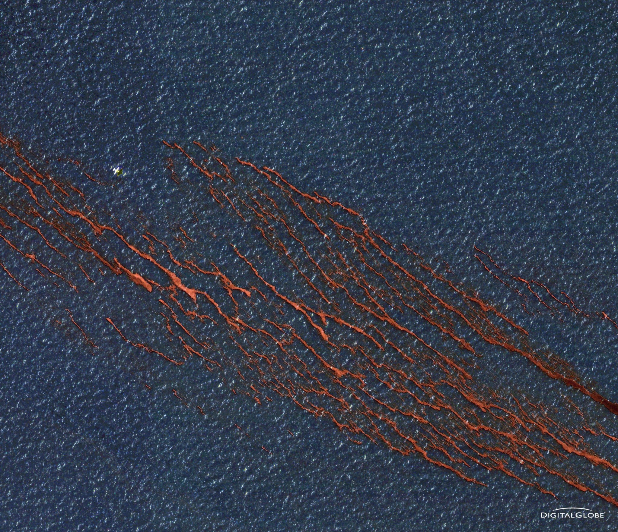
The massive oil spill from a BP offshore drilling rig threatens marine ecosystems and fisheries as it makes its way to the shoreline. Here’s how it looks from above.

The Macondo well is spilling 5,000 barrels of oil per day into the gulf, about five times more than well owner British Petroleum initially reported. Efforts to stem the leak using controlled burning and even undersea robots have been unsuccessful so far.

 
Outdoor gift guide content widget

2025 PopSci Outdoor Gift Guide

 
Rebecca Boyle is an award-winning freelance journalist who writes about astronomy, zoonoses and everything in between. She is a contributing writer for The Atlantic and her work regularly appears in Popular Science, New Scientist, FiveThirtyEight, Wired, and many other publications for adults and kids. Rebecca grew up in Colorado, a mile closer to space, and now lives in St. Louis, near the confluence of the continent's two mightiest rivers.