Mars Global View Of Valles Marineris
Composed of over 100 Viking Orbiter images, this is a mosaic of the Valles Marineris hemisphere of Mars.
With SpaceX declaring that they will land a Dragon capsule on Mars in 2018, and NASA pledging to send astronauts there in the 2030s, Martian colonies are seeming more and more like a reality with every passing day. Sure, there is still a mountain of hurdles for researchers to overcome before we’re sipping our morning coffee on the red planet, but nowadays the idea of Mars coffee isn’t all that foreign–it’s the future. To celebrate that, here are some of our favorite pictures of Mars from over the years, which will hopefully provide us with a preview of what our backyards will look like one day (fingers crossed).
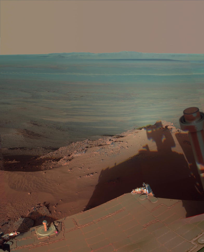
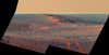
Shadows At Endeavour Crater
Captured with the Opportunity rover’s Pancam on March 9, 2012, shadows fall over the western rim of the14-mile-wide Endeavour crater, the largest impact crater on Mars.
The First Martian Sand Dune Studied By Curiosity
Looking like waves on the high seas, these are the Bagnold Dunes near Mount Sharp. They were studied by the Curiosity rover on November 27, 2015, which was the rover’s 1,176th Martian day, or ‘sol,’ on the red planet’s surface. Just like Earth’s deserts, these sand dunes are constantly changing with the winds and can move up to one meter per year.
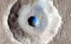
An Icy, Terraced Crater
While it may look like a normal crater with an icy center, there’s a lot going on in this image. According to NASA, most small impact craters on Mars look like small bowls. However, this one has a hole in the middle surrounded by a long terrace, giving the crater an eyeball-like appearance. These terraced craters highlight how much underground ice is hidden beneath Mars’ surface. Basically, the impact was strong enough to smash into the ice but the blast only knocked the surface materials outward, leaving a terracing effect over the unbroken icy bits. The image was taken in 2014 by NASA’s Mars Reconnaissance Orbiter.
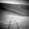
Rover Tracks Near The Endeavour Crater
On August 15, 2014, Opportunity beamed back this panoramic image of its tire tracks while exploring the western rim of the Endeavour crater. If you look closely, you can see its tracks extend down toward Murray Ridge from earlier in 2014.
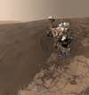
Curiosity Selfie
Even rovers can’t stop themselves from taking a selfie every once and a while. Snapped on January 19, 2016, Curiosity shows off its latest travels to the Namib Dune. The reason you do not see the ‘selfie stick’ used to take this is because it’s actually 57 images stitched together. Curiosity has been documenting many of its rover-ly travels with selfies, and this is likely not the last.
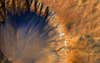
Mars Global View Of Valles Marineris
Taking a step back from the Martian surface, this image is a mosaic of the entire planet captured through 102 Viking Orbiter pictures. Taking center stage is the Valles Marineris, a Martian canyon system that’s over 2,000 kilometers long and eight kilometers deep. These large canyons were once ancient rivers that slowly eroded the surface, just like the Colorado River dug out Earth’s Grand Canyon.
Opportunity Spies A Dust Devil
Taken from the north-facing slope of Knudsen Ridge on March 31, 2016, Opportunity captures a dust devil with its Navcam. While dust devils are quite common the Martian surface, there aren’t too many images of them lingering around, especially ones that also feature rover tracks. It’s a double whammy of awesome.
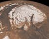
Northern Ice Cap
In 2010, NASA’s Mars Global Surveyor snapped this image of Mars’ ice cap, which measures some 1,000 kilometers (621 miles) across. The ice cap is made out of frozen carbon dioxide, and the ripples are actually deep valleys covered in shadow.
The Crisp Crater
This image, released in June 2015, showcases the Crisp Crater in Sirenum Fossae. In it, you can see the materials ejected from the crater on impact and the gullies carved into it.
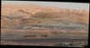
The Bagnold Dunes From Inside Gale Crater
While there are many images of dunes on the Martian surface, this one looks a lot like many areas on Earth. Curiosity captured this snapshot of the Bagnold Dunes from inside Gale Crater near Mount Sharp on September 25, 2015.