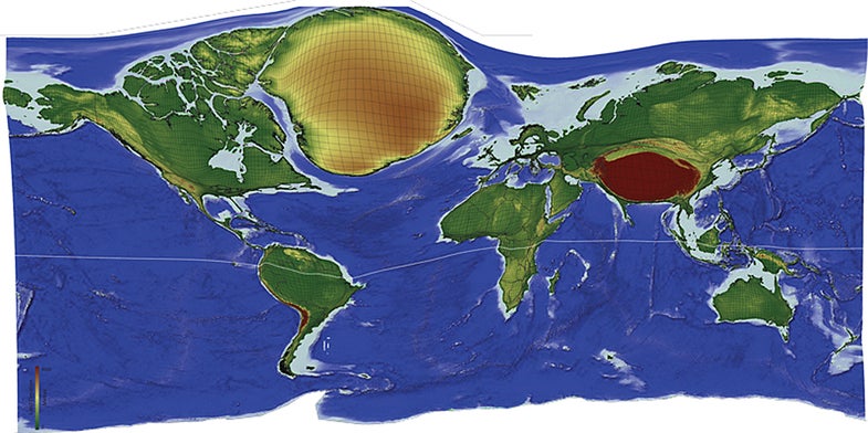
Earth’s Most Remote Locations Revealed In ‘Lonely Planet’ Cartogram
One of our 15 favorite recent data visualizations

Cartograms—maps distorted so that instead of land area, they portray another quantity such as population or electoral-college votes—have existed since the early 1900s. Benjamin Hennig has refined the technique, and he made this cartogram to show the planet’s most remote places. He calculated the travel time from each spot on Earth to the nearest major city, then grew or shrunk the land at those points accordingly. The most remote spots appear biggest, while the densely settled areas, such as Europe, appear smallest.
See all 15 of our favorite recent data visualizations here.
This article was originally published in the November 2014 issue of Popular Science, under the title, “Dawn of the Data Age.”

A Lonely Planet