New satellites can pinpoint methane leaks to help us beat climate change
Gas-sniffing orbiters are helping clear the air of a common and overlooked pollutant.
On January 13, 2019, while trying to measure the greenhouse gas output of a mud volcano in Turkmenistan, a microwave-size satellite known as Claire stumbled upon something unexpected: an enormous cloud of methane spilling into frame from an area just south of the peak. “We couldn’t believe something that large was actually there,” says Stephane Germain, the CEO and co-founder of GHGSat, the Montreal-based company that operates Claire. Curious as to where it could be coming from, Germain and colleagues looked at images of the area and zeroed in on a gas facility called Korpezhe. The source of the pollution seemed to be a pipeline.
Through diplomatic channels, the company passed the information to Turkmen officials. Flying over Korpezhe a few months later, Claire found the plumes had disappeared. The assumption is that they’d come from leaky equipment that site managers had been able to patch.
Claire’s discovery points to a novel means of solving a mystery that has far-reaching implications for the climate: What are the specific sources that are contributing to a dangerous increase in the powerful greenhouse gas methane, whose atmospheric concentration has nearly doubled in less than 70 years?
Environmentalists and policy makers concerned about climate change have focused for decades on carbon dioxide, the most abundant greenhouse gas. When scientists started ringing alarms about its rising levels 40 years ago, it looked as if we still had time to compel sectors responsible for the bulk of CO<sub>2</sub> emissions, including transportation and energy, into action. The hope was that regulations, such as stiffer gas mileage requirements on vehicles and penalties for companies that use the atmosphere as a dumping ground, would incentivize reductions. But cap-and-trade markets in Quebec, California, and Europe plus the voluntary Paris Agreement of 2015 have not been enough to limit global warming’s effects, now evident in Australia’s burning forests and Houston’s flooded streets. “If you want to do something in time to meet the Paris targets, you need a faster response,” says Bill Hirst, a physicist who until June 2020 was the principal scientist for atmospheric monitoring at the gas-and-oil giant Shell.
That urgency makes methane, or CH<sub>4</sub>, arguably a more important target in the short term. Carbon dioxide lingers in the atmosphere for 100 years or more, so curbing its emissions won’t affect the climate at least until the 2100s. Methane, on the other hand, starts breaking up after a decade, but over 20 years, it’s 84 times as potent as CO<sub>2</sub>. Dial it down, and you’ll see results by the time Greta Thunberg can get a Ph.D. “Dramatically reducing or even zeroing industry CH<sub>4</sub> emissions should be a no-brainer,” says Gabrielle Pétron, an affiliate research scientist at the Carbon Cycle Group of the National Oceanic and Atmospheric Administration.
Since 2009, satellites, including ones serviced by NASA, have been circling the globe quantifying greenhouse gases for climate modeling. But those orbiters were designed to measure concentrations of emissions across the entire planet, not to identify specific sources, like a leaking valve in a pipe in Turkmenistan. Claire is part of a generation of smaller, cheaper spacecraft that are now in flight, ready to launch, or on the drawing board. The newer models boast higher-resolution equipment, able to pinpoint the origin of a discharge.
To be sure, there are other methods for cataloguing methane. Just three years ago, driving around in a car with a gas detector affixed to the roof was considered state of the art. But given the limited speed of an automobile, that’s practical only if you have a target in mind—and to get close enough, in many cases you’d need permission from suspected polluters. Planes and hot-air balloons cover a bit more ground, but they’re still pretty localized, and to track changes you’d need to fly again and again, which gets expensive. Satellites like Claire circle Earth every day.
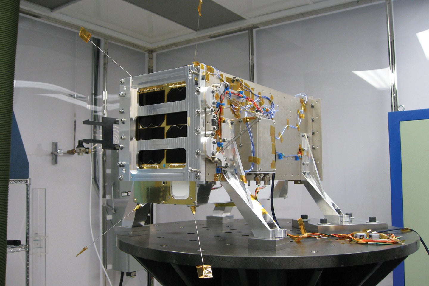
Claire was an international effort. The University of Toronto’s Space Flight Laboratory designed and built it, and the Indian Space Research Organisation launched it from a site near the southeastern coastal city of Chennai in June 2016. A 353-ton, 145-foot-tall rocket carried 20 satellites to photograph, map, and take the temperature of Earth and certain points on its surface—a far-reaching remote sensing mission.
Almost a third of the way around the globe, 8,265 miles away in Toronto, Daniel Kekez, an electronics and software developer at the flight lab, anxiously watched the launch broadcast. He was in charge of Claire’s commissioning process—powering it up and beginning to put it through its paces. Though the Indians had provided him with an estimate of where they would inject Claire into space, he needed to wait until the satellite, officially known as Sat-D, passed over Toronto, the site of the only ground station licensed to transmit to it. Once Claire was within range, he could attempt to make contact. “We communicate in the blind, hoping it will respond,” Kekez says. It did, on the first try.
Then it was time to see if Claire could do what it was designed to. Over the next several weeks, Kekez and his colleagues grabbed measurements as it sailed over methane sources—coal mines, gas facilities—whose quantity of emissions they already knew, just to check that the instruments worked properly.
Claire measures methane using a device called an imaging spectrometer, which is essentially a camera that is sensitive to wavelengths of light invisible to humans. Those on satellites can measure ultraviolet, near-infrared, or shortwave infrared beams from the sun bouncing back off Earth. Different gases absorb specific wavelengths of light, so researchers can determine how much CH<sub>4</sub> or CO<sub>2</sub> there is at a particular location based on how much signal in those bands makes it to the spectrometer. Shortwave infrared reveals CH<sub>4</sub> information. Of course, there are all sorts of confounding factors. Earth’s reflectivity is greater in the Sahara Desert, for instance, than elsewhere; to the untrained eye, this makes it look as if a giant methane cloud hovers over North Africa, larger than is plausible, given the production capacity of Algeria and Libya. Aerosols—tiny particles of solids or liquid suspended in air and clouds—are another pain. Operators study the near-infrared band to figure out what’s aerosol and what’s methane.
The case for targeting CH<sub>4</sub> has been growing. In a paper published in February 2020 in Nature, University of Rochester geoscientist Benjamin Hmiel found that environmental scientists and atmospheric chemists may have been underestimating the methane emissions from fossil fuels in the atmosphere by as much as 40 percent. Research into the reason for the recent spike continues: It might be a function of changes in how the atmosphere processes CH<sub>4</sub>, or the result of human activity, such as oil and gas production. “The only way to reduce this uncertainty,” according to the International Energy Agency, an intergovernmental organization in Paris, “is to continue to improve data transparency.” Precisely what GHGSat and others are trying to do.
What is certain is that the energy industry has been miscounting its contribution. “No one wants to spend money to measure what they’re not required to,” says Hirst, the atmospheric monitoring expert. Companies report rough calculations of facility emissions, but Hirst says these figures are “a glorified guess,” mainly because they don’t account for fugitive emissions (i.e., leaks).
Pretty much anytime anyone has looked, it’s turned out that the CH<sub>4</sub> emissions from oil and gas operations in the United States, the world’s largest oil producer, are far higher than what the industry or the Environmental Protection Agency—including under President Obama—has estimated. Sixty percent higher, according to research published in Science in 2018. (Only Norway maintains stringent regulatory standards and a stiff tax on methane released in production, so there’s no reason to believe other international operators are any better than those in the US.) An April 2020 report in Science Advances found the biggest methane source ever—2.8 million tons per year—above the more than 7,000 fields of oil and gas in the Permian Basin, which straddles Texas and New Mexico. Co-author Sudhanshu Pandey, an atmospheric scientist with the SRON Netherlands Institute for Space Research, which analyzes CH<sub>4</sub> data from European Space Agency satellites, says, “What we see is that the emissions here are more than two times higher than what the estimation methods were predicting.”
On the day of its Turkmenistan discovery, Claire was testing its spectrometer by flying over a known methane release from the mud volcano. Occasionally GHGSat takes measurements over such a source to check the sensitivity of its instrument. Claire had flown over this peak before, and operators had assumed that the plume at the edge of the images they’d collected was a distortion—”noise” from surface reflectivity or aerosols skewing the reading. Upon closer inspection, though, it seemed this wasn’t just interference, and they decided to see if the European Space Agency’s monitoring instrument Tropomi could validate the discovery.
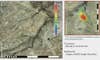
Tropomi is the spectrometer aboard the ESA satellite that keeps tabs on greenhouse gases; it constantly photographs Earth’s surface to quantify all the methane in the atmosphere. Its field of view stretches almost the equivalent of New York to Denver, with each pixel covering what would be nearly 1,000 blocks in Manhattan. That’s great for seeing large concentrations of CH<sub>4</sub>—places where it’s accumulating because of wind or other factors, which are not necessarily where the gas is coming from. (By comparison, Claire’s field of view is only about the size of San Francisco, with each pixel a little smaller than an average supermarket—ideal for spotting leaks.) The agency had never worked with GHGSat before, but was happy to look for the plume in its own data. As Germain had predicted, Tropomi picked up the signal from Turkmenistan. It was the largest leak ever recorded—almost half again as large as the previous record holder, from a 2015 accident at a natural gas storage facility in Aliso Canyon, California.
Going over satellite photographs of the area, Germain’s colleagues found methane clouds that corresponded to the spots in the energy facility where natural gas gets compressed for transport and where it’s purified, as well as at the pipeline connecting the two sites. Once alerted, the plant ended the emission—an unexpected move in the former Soviet republic that Human Rights Watch has called “virtually closed to independent scrutiny,” and that has a single, state-owned gas company accountable to no one.
Such large bleeds are rare but have big effects: According to 2016 research published in Environmental Science & Technology, half of fugitive emissions come from just 5 percent of methane leaks—things like loose valves, Germain says. The US alone has around 1 million oil-and-gas facilities, each with possibly hundreds or thousands of valves; even 5 percent of that is too many to locate or monitor from the ground.
Now GHGSat and the ESA work together to locate leaks. Whenever the team running Tropomi finds an anomalously large plume, it tips GHGSat to go check it out. With such a tight field of view, Claire can zoom in on the spot where the ESA has detected a concentration. Operators on the ground then take the image spectrometry from Claire, calculate the effect of wind speed and direction on the found gas plume, and determine where it’s coming from. Since Turkmenistan, Germain says, “We’ve found several other sources, and we’re working with the operators to get those emissions reduced.”
More satellites like Claire are on the way. In September 2020, GHGSat launched Iris, which can pinpoint emissions one-tenth the size of those Claire can spot. The Environmental Defense Fund is planning its own orbiter, MethaneSAT, which will combine a field of view about a tenth of Tropomi’s with a precision its backers describe as unprecedented. Taking off in 2022, it will make weekly sweeps of the areas of the globe that account for 80 percent of all oil and gas production. Germany and France are collaborating on Merlin, which, when it goes up in 2024, will use lidar—a technology popularized by self-driving car navigation that works like radar, but with light instead of sound—to scan through clouds and distinguish methane from water vapor and surface reflectivity. Bluefield, a company based in New York City, is planning a constellation of 10 satellites even smaller than Claire by 2023. These will measure the gas with a spectrometry technique it contends will be more sensitive than the one other orbiters use. (The US has been a laggard in climate-focused remote sensing from orbit since a Republican administration mothballed the Deep Space Climate Observatory in 2001, delaying its launch by more than a decade.)
Some of these satellites will service governments that signed on to the Paris accord. Others will sell their data to oil and gas companies that want to reduce their emissions in order to shrink what they owe to cap-and-trade markets, in which energy producers and others pay for the greenhouse gases their operations generate. Companies may also want to improve their reputations among consumers, or figure out if it’s worth the investment to capture and sell methane as energy. Natural gas, which provides about 38 percent of the electricity in the US, is virtually all CH<sub>4</sub>.
The value of the gas that drillers leak hits $2 billion annually, according to estimates published in Science. A June 2020 report from the independent research group Institute for Energy Economics and Financial Analysis found that Texas oil companies wasted $749 million venting methane in 2018; the Texas Railroad Commission, the state regulator with oversight, declined to take action. In fact, the International Energy Agency says the global industry could reduce methane leaks by 75 percent—about a third of it at no net cost, since it could finance the fixes by selling much of what it recovers.
Once we figure out the whos and wheres of methane emissions, what do we do with all that data? One idea is a dedicated cap-and-trade scheme for the gas. The one the European Union uses regulates various greenhouse gases but not CH<sub>4</sub> yet. California and Quebec lump it with CO<sub>2</sub> as a “carbon-dioxide equivalent,” as the EU does with nitrous oxide and perfluorocarbons. But Adam Hawkes, director of the Sustainable Gas Institute at Imperial College London, argues in a 2018 paper that conflating the two doesn’t account for methane’s greater short-term global warming potential.
Hans Stegehuis, a former hedge fund trader who works on financial markets and operational risk at Dutch bank ABN Amro, has an idea (his own, not his bank’s) for a methane-trading system modeled on the EU’s current scheme, but that learns from what he views as its major mistakes. These, he says, include an oversupply of emissions credits that pushed down the price and therefore disincentivized reductions, and variations in how countries estimate such releases. For example, a landfill in the United Kingdom miraculously emits—on paper—a tenth of the methane produced by an identical facility in Germany. Stegehuis’ system would reduce the supply of credits, solving the first problem. Satellites would address the second, he says, because “now you can quantify who’s emitting what.” He envisions a fund set up from the proceeds of overage fines to help finance the development of methane abatement technologies.
“I think I’d encourage” measures like the one Stegehuis proposes, says Richard Sandor, an economist at the University of Chicago Law School who initiated cap-and-trade markets for carbon. But new financial markets require more than just a good idea. “It takes a decade to build the credibility, educate the users, the businesspeople—the nature of it depends on consensus,” he says.
When Stephane Germain conceived of GHGSat, it took more than 100 cold calls to energy companies to satisfy himself that his venture could find customers. Now, under pressure from investors, Shell has tied its executive compensation to its emissions reductions, aiming for 20 percent in 15 years, and has hired GHGSat. BP has promised to add methane-measuring devices at its major processing sites in three years and halve its emissions per volume of product. Activists who own stock in ExxonMobil, Chevron, and others have become increasingly ornery about greenhouse gases, so they may win more concessions from executives on environmental metrics. Saudi Aramco, the national oil company that went public in 2019, may also begin to feel pressure from shareholders.
Hirst, the atmospheric monitoring expert, believes that these moves have at least partly been motivated by the coming swarm of orbiters sniffing out leaks. “Within a few years, they will show how bad these sources are,” he says. “As more sensitive satellites are launched, it’ll become more common to see sources that need remediation.”
When everyone can look at a map of the world and zoom in to see where methane is coming from, and when regulators can quantify the amounts and start charging for them, polluters might decide business as usual is no longer a viable option.
This story appears in the Fall 2020, Mysteries issue of Popular Science.