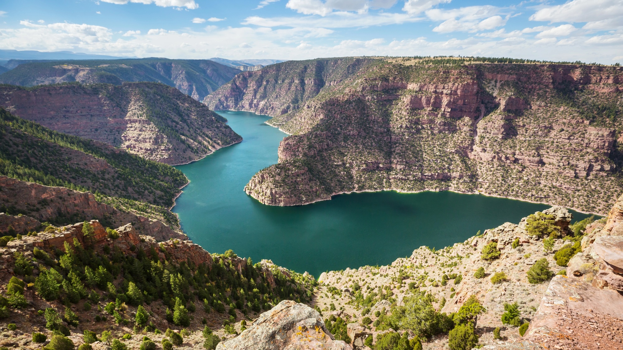
The Green River doesn’t make a lot of sense at first glance. The Colorado River’s largest tributary flows through a nearly 2,300-foot-deep canyon inside of northeastern Utah’s Uinta mountain range. But at almost 2.5 miles high, the massive, 50-million-year-old rock formation hypothetically shouldn’t have even yielded to the nearby Green River, which itself began to form less than eight million years ago. After examining a combination of seismic imaging and data modeling scenarios, an international research team now believes they can explain this longtime mystery behind one of North America’s most prominent river systems.
Water typically follows the path of least resistance. If a stream encounters an immovable object such as a large rock, fluid physics dictates that it simply follows both gravity and inertia towards an easier route forward. This isn’t to say that water isn’t powerful in its own ways. Some of the world’s largest canyons were carved by comparatively small currents over millions of years—but even then, their winding trails typically follow a uniform logic.
This makes the story of how the Green and Colorado Rivers met so perplexing to geologists like Adam Smith at Scotland’s University of Glasgow. According to the coauthor of his team’s study published on February 2nd in the Journal of Geophysical Research: Earth Surface, the region is “enormously significant” to the overall landmass.
“The merging of the Green and Colorado Rivers millions of years ago altered the continental divide of North America,” he explained in a statement. “It created the line that separates the rivers that flow into the Pacific from those that flow into the Atlantic, and created new habitat boundaries for wildlife that influenced their evolution.”
Geologists like Smith have already debated about the river merger for around 150 years. It’s a particularly vexing subject given the area’s tectonic inactivity and lack of major geological events. However, researchers have recently begun analyzing a novel concept known as lithospheric drip. This phenomenon begins when a dense layer of mineral-rich substances forms at the base of the crust. Over time, the layer grows heavy enough to sink into the mantle. When this happens, the descent can also tug on the land above it and even lower a mountain range like Uinta. Eventually, the mineral layer breaks away and continues to sink further into the mantle. The mountains then appear to bounce back in its wake, and in the process forms a bullseye-like region in the landscape.
Smith and collaborators relied on seismic imaging to locate evidence of lithospheric drip in Utah. This technique works like a CT scan of the Earth to analyze the seismic waves created during earthquakes. While reviewing previously published seismic image studies of the Uinta Mountains, the team spotted a comparatively cold, round space about 125 miles below the Earth’s surface with a diameter measuring 31 to 22 miles across. They now believe this discovery is an ancient, broken fragment of a drip.
“We think that we’ve gathered enough evidence to show that lithospheric drip…is responsible for pulling the land down enough to enable the rivers to link and merge,” Smith said.
Given the likely speed of descent and its current depth, the study’s authors estimate the drip broke away two to five million years ago. This timeline corresponds to previous work suggesting the Green River carved into the mountains and joined with the larger Colorado system. Geological modeling further confirmed their hypothesis. After measuring the Uinta Mountains’ lithographic drip bullseye pattern, they discovered the underlying crust is many miles thinner than it should be given the range’s height. A final calculation of surface rebounding for these drip parameters aligned with their estimate of the river network’s more than 1,312-foot fluctuation in elevation.
“The evidence we’ve collected strongly contradicts the idea that the river predated the mountains, or that sediment deposits might have built up enough for the river to overtop the range, or that erosion from the south of the mountains captured the Green River,” said Smith.
The study’s authors believe their theory doesn’t only answer a multigenerational mystery—it provides a template for applying lithographic drip analysis to many other lingering tectonic debates around the world.
