Tandem Pair of German Orbital Imaging Satellites Will Create Sharpest-Ever 3-D Map of Earth
A Dnepr rocket lifting off from Kazakhstan has successfully launched the second half of the world’s most precise 3-D mapping...

A Dnepr rocket lifting off from Kazakhstan has successfully launched the second half of the world’s most precise 3-D mapping mission of the globe into orbit today, setting in motion a tandem effort that will see two orbiting spacecraft fly in tight formation that will bring them well within 700 feet of each other as they map the earth’s topography over the next three years.
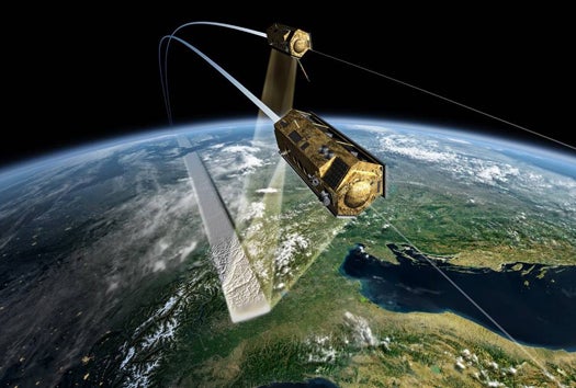
Germany’s TanDEM-X (TerraSAR-X add-on for Digital Elevation Measurement) successfully separated from its carrier rocket and was put into a polar orbit slightly inclined to the one it’s sister satellite, TerraSAR-X. Together, the two will dance an intricate orbital tango as TanDEM-X flies a tight pattern around TerraSAR at an altitude of about 320 miles above the Earth. It’s the first time two satellites will orbit in such a tight formation for such an extended period.
By bouncing microwaves pulses off the planet’s surface and timing the return signals, the satellites’ highly sensitive instruments will be able to map the entire land surface of the earth in extreme detail. TerraSAR-X alone has been able to map the surface to within an accuracy of about 30 feet, but with TanDEM-X at its side that accuracy should be pared down to within six-and-a-half feet.
A 3-D map that accurate will have vast military, research, civil, and commercial applications, ranging from tighter low-flying routes for strategic aircraft to better-organized search and rescue plans during earthquakes to more accurate city planning and land use assessments. Further, while other 3-D topographic maps have been piecemeal efforts, the TanDEM-X mission will be one single, cohesive map of the entire surface of the planet. With the satellites both in orbit, work now is focusing on upping the resolution so allow the rendering of detailed, massive images from the data collected from a single pass overhead.