Video: Swoop Through the Real New York as Google Earth Meets Google Street View
We may earn revenue from the products available on this page and participate in affiliate programs. Learn more › Google...
We may earn revenue from the products available on this page and participate in affiliate programs. Learn more ›
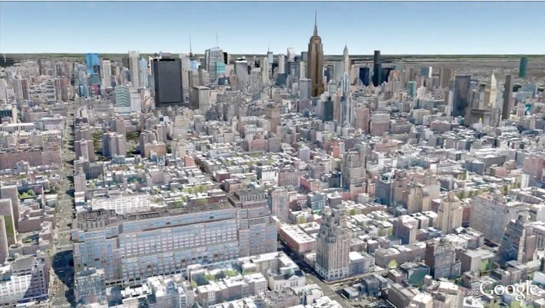
Google Earth has long allowed users to zoom in on textured, three-dimensional representations of cities, but the view was more or less limited to one angle: straight down. But the search giant has now mashed up its wealth of high-res Street View data with some existing city textures, making it possible to zoom right down to street level and take in a pedestrian’s view in 3-D.
What was once a kind of grainy, pixelated experience — at least if you zoomed in really tight — is now much more like the real deal. Building facades and architectural nuances are in focus, storefronts are legible, and landmarks can be explored in a far more realistic fashion than before. You could even argue that the ability to fly through cities, experiencing them from both ground level and from their upper stories and beyond, beats pounding the pavement yourself.
Currently, the 3-D experience is limited to a smattering of international cities — New York, Cape Town, London, etc. — but more 3-D-enabled locales are surely on the way, as Google’s mission is, after all, to catalog everything in the world. You can take a spin around NYC below.