Wildfire smoke travels far but never really disappears
Even after the densest clouds disperse, the effects from smoke last longer and travel farther than you might think.
For several awful days in early September, it seemed like the entire West was burning. Unusually high winds coming off the western slopes of the Rocky Mountains fanned the flames of dozens of new wildfires that touched off from Washington to Mexico. In California alone, nearly a million acres burned in the period between September 7 and September 10.
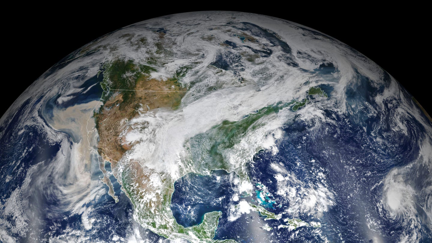
Air quality deteriorated rapidly. In San Francisco, the iconic Golden Gate Bridge was shrouded in an apocalyptic orange haze. The air quality index in some places soared above 500, the upper threshold in the Environmental Protection Agency’s Hazardous category. Less than a week later, residents on the East Coast and Europe noted hazy skies as the smoke drifted on the winds.
With hundreds of thousands of acres on fire, it’s not surprising that most of the West was submerged in smoke; in some cases, communities closest to major fires suffered the worst air quality in the world. But smoke movement is complicated, and where the particles ultimately go depends on a complex of factors, including the intensity of the fire, the topography of the region, and local weather.
When wildfires burn, smoke is sent upwards in a plume. A blaze with more energy will send smoke higher; some will even form towering “pyrocumulonimbus clouds,” which can inject smoke tens of thousands of vertical feet above the earth, even up into the stratosphere. The injection height of smoke plays a large role in where it will end up and how it will affect the air people breathe.
“When smoke is trapped or doesn’t go very high, you see the impact on local or regional communities,” says Craig Clements, Professor of Meteorology and Director of the Wildfire Interdisciplinary Research Center at San Jose State University. “If smoke is lofted high, it can go all around the world.”
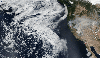
The same strong easterly winds that fueled the flames of those early September fires blew smoke westward over the Pacific Ocean in a mass easily captured by satellites. When the winds shifted, the mass moved back over land, where it blanketed large swaths of Washington, Oregon, and California.
Smoke from the main plume of a fire can move both vertically and horizontally, sometimes borne on winds created by the fire itself. Concentrations of smoke can also fluctuate from day to night, especially where the terrain is complex. A classic example is the inversion layers that form in valleys. “Drainage” winds can pull smoke into valleys at night, where it gets trapped by cooler temperatures. Once sunlight warms the valley floor, the clouds can escape and climb back up hillsides.
Just as local weather impacts smoke movement, so too can smoke change local weather patterns, says Clements. When smoke shades the incoming rays of light, the temperature differential between the shaded and unshaded portions of air can create a “density current” in which air flows from areas of high to low pressure, often in the opposite direction of the prevailing wind. These currents can carry smoke particles far from the origin of the fire.
This “smoke shading” can also suppress ambient wind. A warm and sunny day spurs convection currents, Clements explains. “Eddies and thermals form, which makes the atmosphere more turbulent at the surface,” he says. “There’s more variability in the wind, and fire progression is more erratic.” Thick smoke creates a screen that blocks radiant energy; the earth’s surface cools, and wind activity decreases. That’s good news for firefighters, but it also means smoke is more likely to hang around and impact air quality for a longer time. This is what happened in the San Francisco Bay area in September, when smoke mixed with fog in a thick, toxic soup.
Wildfire smoke is a complex mixture of water vapor, carbon dioxide and monoxide, nitrous oxides, volatile organic compounds, and fine particles. It is this particulate matter that is so concerning for human health. Larger ash particles usually fall out close to their origin. But fine and ultra-fine particles can stay aloft for days or even weeks, unless rain washes them away or they are taken up by clouds. Particles less than 2.5 micrometers in diameter can penetrate deep into the lungs and even make their way into the bloodstream, exacerbating heart and lung conditions such as chronic obstructive pulmonary disease (COPD) and asthma.
As fire seasons grow longer and wildfires increase in intensity in regions like the West, communities need models that can accurately predict the density and location of smoke. One recent study shows that high concentrations of particulate matter from wildfire smoke can significantly increase the odds of seeking emergency care. Smoke models can help public health officials warn residents when air quality is likely to deteriorate so that people can take actions to protect their health.
Current forecasts typically utilize satellite data, weather predictions and estimates of emissions from active fires, which are based on the type and amount of vegetation burned in a given day.
According to Clements, although most smoke forecast models don’t take into account phenomena such as smoke shading, next-gen models are beginning to consider the ways fire and smoke shape weather.
Many of the early September fires, feeding on bone-dry fuels and fanned by high winds, gobbled tens of thousands of acres a day. The Creek Fire, which touched off in California’s Sierra National Forest, grew explosively on September 6, forming an enormous pyrocumulonimbus cloud that reached 45,000 feet into the atmosphere. A significant portion of the emissions from this and other fires rose high enough to catch a ride on upper-level currents. The Jet Stream bore the smoke eastward, where tropical storms off the Atlantic and Gulf Coasts steered and shaped its trajectory further. About a week after the outbreak, East Coast news outlets began reporting that smoke from Western fires was turning sunsets orange; soon after, the mass reached Europe. Because the aerosols were high in the atmosphere, they didn’t degrade air quality nearly as much as in the smoky skies in California, Oregon, and Washington.
The National Weather Service relies on satellites to monitor and forecast the movement of smoke. Instruments such as NASA’s Moderate Resolution Imaging Spectroradiometer (MODIS) capture daily images from two different satellites. The Multi-angle Imaging SpectroRadiometer (MISR), aboard NASA’s Terra satellite, takes images from nine different angles.
But as valuable as they are for tracking smoke, satellites have their limitations, says Gregory Schill, Research Scientist at NOAA Chemical Sciences Laboratory. Satellites can only peer down on smoke plumes from above or from oblique angles, and their payload is limited to lighter instruments. For this reason, researchers have been racing toward fires with ultra-sensitive ground and air-based instruments, hoping to learn as much as they can about smoke composition, behavior, and interactions with the atmosphere.
But even after smoke dissipates, it doesn’t just go away, says Schill. Between 2016 and 2018, he and other researchers flew to remote areas above the Pacific and Atlantic Oceans in a plane loaded with highly sensitive instruments for the Atmospheric Tomography mission. To their surprise, Schill and his team learned that, on average, smoke makes up about one-third of the “background particles” in the troposphere, which extends from the Earth’s surface up to about five to nine miles above it.
Schill and his team used NOAA’s Particle Analysis by Laser Mass Spectrometry (PALMS) to study the composition of individual smoke particles. Smoke contains a mixture of light-colored organic and sulfate particles and dark-colored black carbon. As for the impact of these particles in the atmosphere, “it’s complicated,” says Schill. Dark particles absorb light, while lighter particles reflect it, but “how these particles impact climate really depends on what’s underneath them,” he says. While dark particles above a dark surface such as the ocean don’t do much, those same particles above ice may have a warming effect. Conversely, light particles above the ocean may exert a cooling effect.
Collectively, remotely dispersed smoke, though undetectable by satellites, creates as much dimming as the dense plumes from active wildfires. While researchers are still puzzling out exactly how these particles impact climate in the long-term, Schill says the impacts of this more dilute smoke on global climate can’t be ignored.
Ten days after the rash of fires in early September, parts of Oregon and Washington received welcome rain. Skies cleared temporarily, and people ventured outside to breathe deeply and relish the blue skies. Unfortunately, the reprieve was short-lived. On September 27, new fires broke out in California’s wine country and in Shasta County, adding to what has become an all-too familiar pattern: more evacuations, more firefighters, and more smoke.