Five wild facts about the Saharan dust plume before it hits the US
This enormous dust cloud will be touching down in the Gulf Coast today.
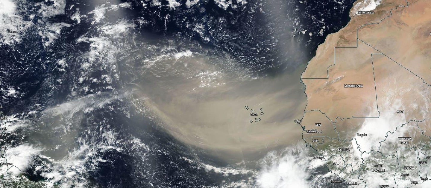
Expansive dust clouds arise from the sun-baked Sahara each year, making the 5,000-mile journey across the Atlantic Ocean to the southern United States. While these dust plumes tend to stay intact while traveling across the ocean, they typically diffuse by the time they hit the Caribbean. But this year, things are different.
This month’s dust cloud is more resilient than usual—its dust is so opaque and thick that it can be clearly seen from the International Space Station, while its predecessors have been ghostly and faint from space. Astronaut Doug Hurley photographed the cloud from the ISS on June 21, tweeting, “We flew over this Saharan dust plume today in the west central Atlantic. Amazing how large an area it covers!”
These dust plumes, called the Saharan Air Layer (or SAL) are born when severe wind storms strike the Sahara. Entering the Atlantic Ocean at the Intertropical Convergence Zone, the plumes catch on to the trade winds, which run east-west along the equator.
The dust is already covering Caribbean skies, and Gulf Coast states like Texas and Louisiana should expect to confront this vast cloud on Wednesday and Thursday. Before the cloud enters the US here’s what you should know about the plumes.
The dust will aggravate pre-existing asthma, respiratory illnesses, and allergies
Puerto Rico’s Department of Health issued a warning for residents with respiratory issues, noting that the dust will bring hot, dry air—the recipe for triggering asthma. During the COVID-19 pandemic, experts warn those in the path of this dust plume should wear masks and practice caution when breathing outdoor air, since the conditions could also exacerbate respiratory issues caused by the virus.
The plume suppresses hurricanes and tropical storms in their tracks
The dry layer of hot air currently covering the Atlantic will act as a muffler for potential hurricanes and tropical storms, since it prevents the gathering of warm moisture needed to precipitate these summer vortexes, according to the National Weather Service. Once the dust drops out of the atmosphere, we’ll again be at the mercy of an active upcoming hurricane season.
Particles from the plume make the skies more colorful
Across various Caribbean islands, people have been documenting dazzling, colorful sunrises and sunsets. Though you can get hazy, yellow-brown skies from thicker coverage, thin dust clouds create spectacular red hues by scattering (and thus enhancing) the shorter, blue waves of light. Get your cameras and face masks ready.
This phenomenon fertilizes the Amazon Rainforest
Hundreds of millions of tons of Saharan dust blow across the Atlantic each year, and a lot of it ends up in the Amazon. In a 2006 study, scientists revealed that almost half of the nutrients that fuel the Amazon come from a single Saharan valley called the Bodélé Depression, which is about the third of the size of Florida. The area’s twin mountain chains funnel winds along the surface, kicking up 0.7 million tons of dust every day.
This dust cloud transformed the Bahamas into the glorious ecosystem it is today
Geologists have long puzzled over the thriving ecosystem in the Bahamas, which is surrounded by an expanse of nutrient-poor ocean. Based on a 2014 study, scientists claim that dust blown from the Sahara desert provides the carbon and mineral-rich foundation needed to support the Bahamas’ stunningly diverse marine life and coral reefs. On the flip side, severe Saharan dust storms can also endanger coral reefs by depositing an overwhelming amount of nutrients, which promote poisonous algal blooms, and by bringing along toxic agricultural contaminants mixed in with the dust.
Correction: A previous version of this article mistakenly said that particles in the air help scatter shorter, red wavelengths of light. In fact it is blue wavelengths that are shorter. This error was introduced in edits and has been corrected.