Hurricane Rosa could flood the parched Southwest next week
Even small amounts of heavy rain can pose a problem in the desert.
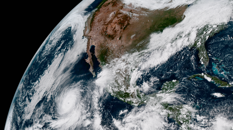
Hurricane Rosa could pose a flooding threat to desert southwest and parts of the Rocky Mountains in the middle of next week as the storm makes a sharp turn toward northwestern Mexico. Forecasters are only expecting a couple of inches of rain—nothing like we’ve seen from recent storms out East—but the impermeable ground in the Southwest makes even a short burst of heavy rain a dangerous prospect for people in vulnerable areas.
The eastern Pacific hurricane season is churning out storms in abundance this year. Rosa is the tenth hurricane to form in this part of the world this season, and it’s the first storm to significantly threaten the Mexican coast. Rosa grew into a major hurricane on Thursday afternoon, taking advantage of warm water, moist air, and low wind shear in the environment around it.
Weather models have been strikingly consistent, with the trough picking up the hurricane and moving it toward Mexico and the United States. An upper-level trough in the jet stream will dip over the West Coast this weekend, picking up Hurricane Rosa and forcing it to make a sharp northerly turn toward the Baja Peninsula. The storm will accelerate after it turns north; current forecasts show it making landfall on Tuesday, reaching the United States by the middle of the week. However, the timing is less certain than the track.
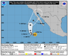
Rosa, either as a tropical storm or the remnants of one, will swiftly move across the Southwest and over the Rockies once it comes inland. The current precipitation forecast from the Weather Prediction Center shows one to three inches of rain falling across Arizona and New Mexico with the passage of the storm next week. Thunderstorms that repeatedly move over the same areas could produce even heavier rainfall.
The ground in the desert southwest is relatively impermeable; heavy rain tends to run off rather than soak into the ground like it would in wetter parts of the country. This excess runoff makes even a relatively small amount of rain a significant flooding problem in both urban and rural areas. Flash flooding in desert regions can happen very quickly, with arroyos (dry creeks) flooding miles away from heavy rain.
The remnants of Rosa will continue to swiftly move through the United States next week, merging with other weather systems to bring heavy rain from the Upper Midwest to New England. Rain that falls in places like Minnesota and Maine next week will have a direct link to the remnants of Hurricane Rosa.
Most storms quickly dissipate once they make landfall in northwestern Mexico, typically sparing the American Southwest from dealing with the severe effects of a landfalling storm. Storms that make it through to Arizona and New Mexico are usually tropical depressions or remnant lows by the time they reach that far inland.
Several tropical cyclones have brought extensive flooding and wind damage to the American Southwest over the past couple of decades. The remnants of Hurricane Nora in 1997 were the most damaging in recent memory. Nora reached Arizona as a tropical storm, bringing intense winds to Yuma, Arizona, and leaving behind nine-figure damages from flooding.