Hurricane Florence could stall out over the East Coast for days, bringing intense flooding
It's looking an awful lot like Harvey.
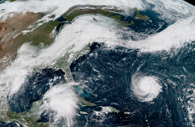

Hurricane Florence should make landfall in North Carolina on Thursday as one of the strongest storms to strike this part of the country in recorded history, and the threat posed by destructive winds and storm surge at the coast is just part of the equation. The hurricane will stall once it’s inland, leading to a potentially-disastrous flash flooding situation across the Carolinas and Mid-Atlantic. The danger could extend hundreds of miles away from the coast.
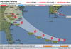
The latest forecast from the National Hurricane Center shows the storm potentially making landfall somewhere along the North Carolina coast as a category four hurricane. Intense hurricanes like Florence typically make landfall closer to Florida and the Gulf of Mexico.
If current forecasts hold true, this hurricane will be devastating for coastal communities in its path. Sustained winds of 130 MPH or greater (with higher gusts) would damage or destroy homes and businesses, significantly damage power grids, and possibly leave some areas unrecognizable. Wind damage will extend far inland, exposing a widespread area to the risk of power outages. A devastating storm surge—seawater pushed inland by strong, persistent winds—would completely inundate parts of the coast in many feet of water. The surge would extend far up the coast from the center of the storm.
The wind and surge are just the beginning. Forecasters expect the hurricane to slow down or even come to a halt once it moves inland. The threat for freshwater flooding from days of heavy rainfall could be the most destructive aspect of this hurricane.
Unfortunately, it’s too early to peg the storm’s precise track. A few dozen miles to the east or west could make all the difference. But anyone from central North Carolina to eastern Virginia—and everywhere in between—is at risk right now for a foot or more of rain.
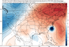
Weather models generally agree that the storm is likely to make landfall in North Carolina during the day on Thursday. The storm is also likely to slow to a crawl once it moves inland. The hurricane is moving into the bottom of a strong ridge of high pressure over the eastern United States and Canada. Ridges usually foster calm weather, but that calm environment will force Florence to sit and spin over the same areas for days on end. Without any other weather systems to push Florence along, some models don’t see Florence moving out of the region until early next week.
A couple of reliable weather models insist that the hurricane will instead scrape North Carolina’s Outer Banks before stalling out near the coast. It’s important to remember that, while there is a slight chance this could happen, official forecasts and most guidance show the storm making landfall and moving inland. Residents need to prepare for the full force of Hurricane Florence. While it’s comforting to wish for the best, it’s a mistake to let the hope of a miss guide your decision-making. Everyone from South Carolina to Delaware needs to watch the storm and be prepared to act.
The situation is eerie in some of its similarities to Hurricane Harvey last year. Harvey, also a category four hurricane, slammed into the Texas coast near Corpus Christi and came to a screeching halt as it moved inland. Harvey slipped inland beneath a strong ridge of high pressure that placed the storm in an environment with no upper-level winds to steer it along. Since there was no mechanism to move the storm out of Texas, Harvey sat over the Houston area for days and produced up to five feet of rain, leading to some of the country’s worst flooding on record.
Coastal residents should prepare for the storm by following the guidelines set forth by local officials. Most areas in the path of the storm will begin evacuations on Tuesday. Evacuations are issued to get people out of areas vulnerable to storm surge. People not in flood or storm surge zones should only evacuate if told to do so, or if an extended period without power or other utilities or services could pose a hazard to health or safety.
Inland residents should prepare for flooding and the potential for widespread power outages. Check to see if you live in a known flood zone and make note of where you’ll go if your neighborhood starts flooding. Scout out additional routes to get around town if roads become impassable due to standing or moving water.
You still have a few days to build a hurricane kit and stock up on supplies. It’s important to have non-perishable food items that don’t require cooking. Canned items like meats, pastas, and fruits are good, as are granola bars and bread to make simple meals like peanut butter and jelly. Filling jugs of water for drinking, washing, and personal hygiene is a good idea in the event that flooding or power failure compromises municipal water services. Stocking up on batteries and physical flashlights is more important than ever now that they’re in dwindling supply in some homes due to the flashlight feature on smartphones.