12 stunning images from past Mars missions gallery

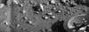
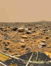
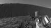
First signals (Mariner 4, 1966)
NASA’s 10-part Mariner program (1962-1973) aimed to look at the surfaces of Mars, Venus, and Mercury. Mariner 4 became the first successful Mars flyby in 1964. It took 22 photos of the red planet, each of which took 10 hours to relay back to Earth. NASA