Denali Gets A New (Smaller) Height To Go With Its New Name
I remember when you were this big
If you give a mountain a new name, its probably going to ask for a new elevation to go with it. Just days after President Obama ordered the highest peak in the country to be renamed Denali, the United States Geological Survey (USGS) decreed today that the mountain was officially 20,310 feet tall…10 feet shorter than its previous elevation.
So does this mean Denali shrunk? Nope. It just means that we are way better at measuring things now than we were in the 1950’s. Back in 1953, when the last survey was taken, researchers didn’t have Global Positioning Systems. They relied on maps, math, and traditional surveying techniques.
This isn’t the first time that the task of re-measuring Denali has been attempted. In 2013, radar measurements of the mountain taken from an aircraft, measured the height at 20,237 feet tall, much shorter than the assumed height of the summit. But the airborne measurement was designed to take broad, general measurements, not pinpoint the exact height of a summit. The only way to put the matter to rest was to send a team up to the top of a mountain loaded with equipment and supplies.
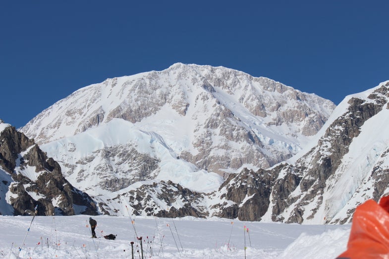
The survey itself took place in June, with a scientific team of four setting off for the peak on June 15, and not arriving back to base camp until June 29. Click through the gallery above to see what they went through in pursuit of Denali’s new elevation.
“No place draws more public attention to its exact elevation than the highest peak of a continent. Knowing the height of Denali is precisely 20,310 feet has important value to earth scientists, geographers, airplane pilots, mountaineers and the general public,” Suzette Kimball, USGS acting director said in a statement. “It is inspiring to think we can measure this magnificent peak with such accuracy.”

Denali

Kahiltna glacier

Climbing

Climbing

Autobahn

Summit

Equipment