Check Out This Beautifully Rendered Image Of A Martian Valley
Mawrth Vallis, looking mighty fine
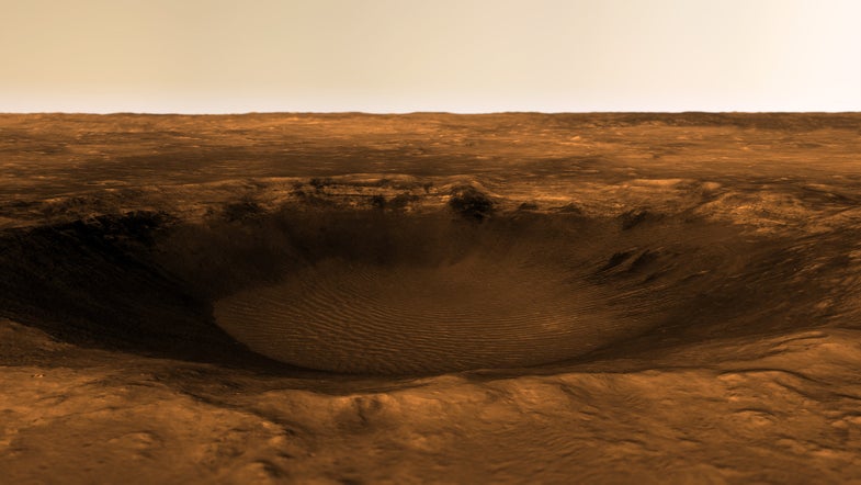
Take a look at this stunning interpretation of Southern Mawrth Vallis, a proposed landing site for ExoMars and a spot of special interest to astronomers.
Kevin Gill, a software engineer at NASA’s Jet Propulsion Laboratory, created this image from high resolution orthoimagery and HiRISE DTM data:
Digital Terrain Models (DTMs) are composites of images of the same area, taken from different angles. They’re difficult and time-consuming to produce, but the results are highly detailed terrain models and extremely valuable to research. High Resolution Orthoimagery (HRO) maps out terrain in great detail, using multiple images to correct for tilt and scale.
Mawrth Vallis has the greatest mineralogical diversity on the planet (that we know of), with rich clay deposits and evidence of past water activity, and is highly likely to pose a habitable environment. It was considered a potential landing spot for the Mars Science Laboratory and Curiosity rover, but lost that bet to Gale Crater instead.
Gill processed the data using the Geospatial Data Abstraction Library, ImageMagick and HiView, the publicly available HiRISE imagery viewer. He rendered it using Autodesk Maya and Photoshop.
If you’re yearning for more Martian views, NASA just unloaded a whole bunch of them, here.