Using Drones To Bring Maps To The Masses — DO NOT PUBLISH
Your drone has a better view of the world than you do
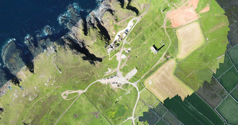
Any drone can snap photos of a house from above. But what if you want a detailed map of your entire neighborhood? No problem. Aerial-imagery specialist Tudor Thomas and his colleagues developed Maps Made Easy, an app that stitches drone photos into a map with resolution up to 20 times that of Google Earth. Before the rise of drones, such detailed cartography required airplane- or chopper-based rigs, which can cost millions of dollars (not counting the price of the vehicle). This app has a processing fee, but mapping more than 60 acres costs less than $15.
This article was originally published in the January 2015 issue of Popular Science, under the title “Drone-Made Maps.”