Click to launch the gallery.
Satellites from NASA, NOAA, and others captured the devastating tornado that this week destroyed many towns and houses and claimed the lives of several (the exact death toll is still unclear) in Oklahoma. Click above for a tour through those shots.
[via Flickr]
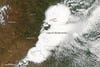
Moore, OK
Taken by NASA’S Aqua MODIS satellite, this image of Moore, OK was taken at 2:40pm local time, just at the beginning of the tornado’s life.
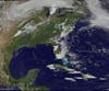
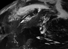
15 Minutes Later…
At 2:55pm, from this wider shot taken by NOAA’s GOES-13 satellite, you can see the line of thunderstorms that created the tornado. (It was generated near the bottom of that line of clouds.)
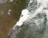
A Closer View
Here you can see a closer look at the shot taken by the Moderate Resolution Imaging Spectroradiometer (MODIS) on NASA’s Aqua satellite. The core of the storm is called a supercell thunderstorm, from which the tornado was spawned.
A Wider View
Here’s a wider view of the storm–highly recommended you go to Flickr and check out the animation. The box in this image is the location of the storm.
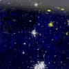
At Night
This nighttime image shows Oklahoma’s power outages. Everything in yellow is dark. This is a composite image made from shots before and after the tornado–what’s different (the power being out) is shown in yellow.
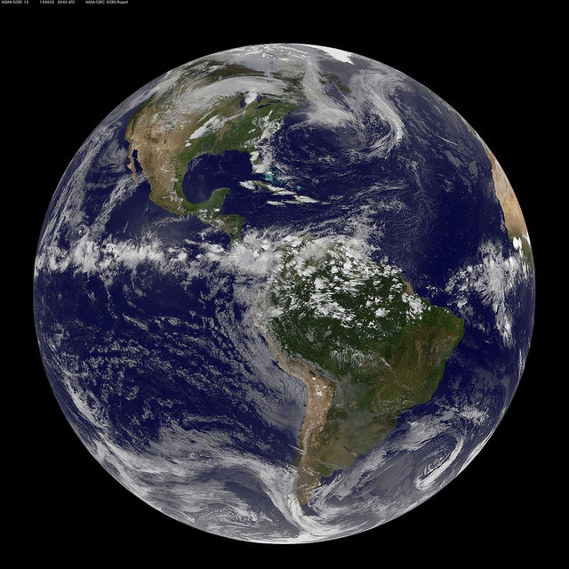
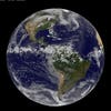
The Full Disk
Here’s a full-on “disk” shot of the planet, taken by NOAA’s GOES-13 satellite. (Fun fact: NOAA is pronounced like the name “noah.”) You can see the storm over the central part of the US.