How to make a sextant from random junk
Navigate like it's ye olden tymes
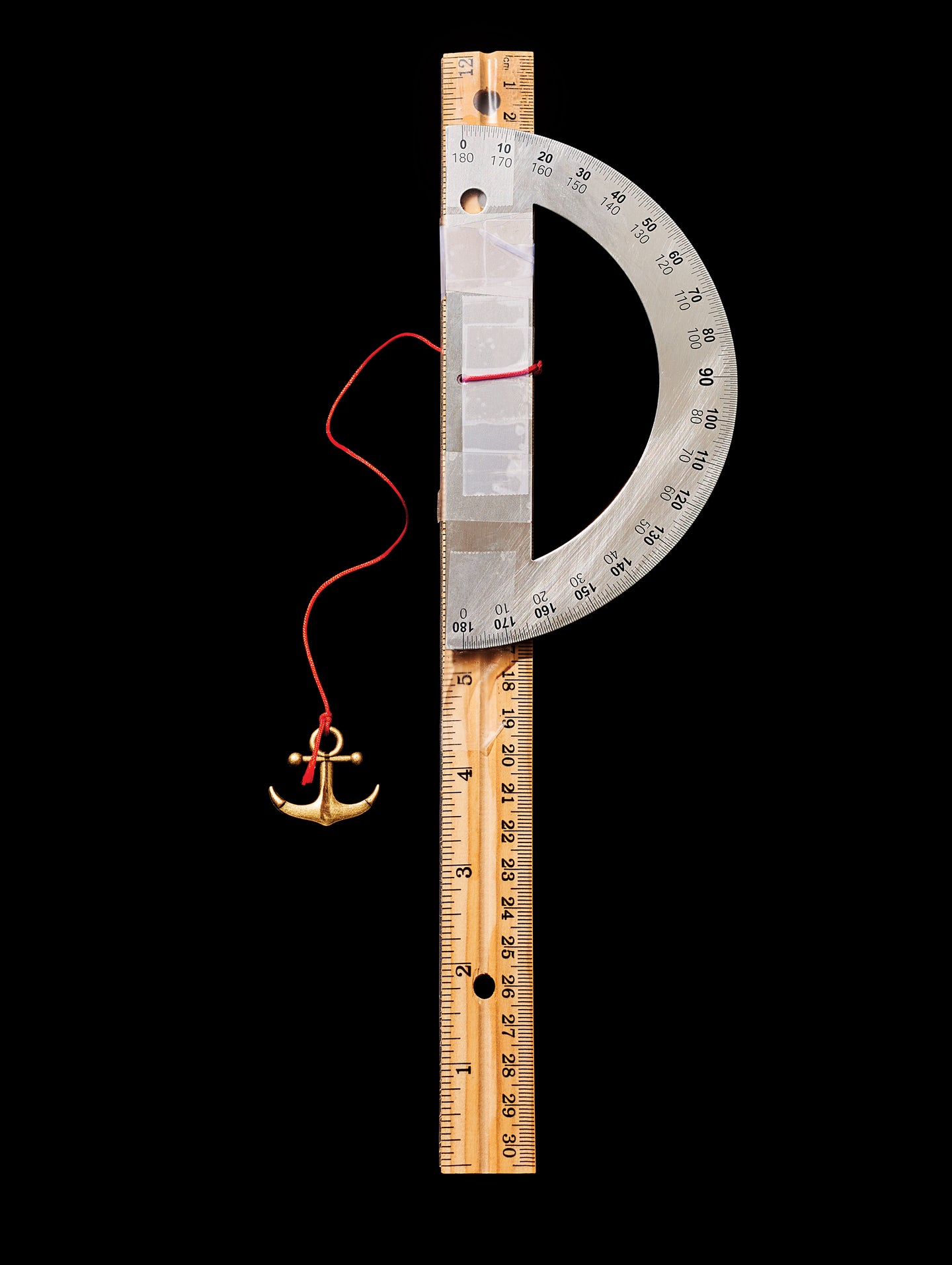
For thousands of years, humans navigated by comparing their positions with those of familiar celestial bodies. They did this with instruments such as the sextant, which measures the angle between a heavenly target and the horizon. Some sextants are precise works of art; others are super-basic devices cobbled together from office supplies. We built the latter. Simple as it is, you can use this DIY sextant to estimate latitude—and navigate like an ancient mariner.
Project Stats
Time: 10 minutes
Cost: $7
Difficulty: Easy
Tools & Materials
Protractor
String
Paper clips
Tape
Foot-long ruler
Instructions
Tie string through the hole in the protractor’s base.
Cut the string to about 7 inches and tie a weight such as paper clips to its other end.
Tape the straight edge of the protractor to the ruler, about half an inch from one end.
On a clear night, hold the ruler up to your eye and sight Polaris (the star at the end of the Little Dipper’s “handle”) down its length. Measure the angle at which the string hangs, and subtract this number from 90. The result is the angle of Polaris’ altitude above the horizon. Polaris is directly above the North Pole, so its angle corresponds to your latitude.
In the Southern Hemisphere, replace Polaris with the southern celestial pole. To find it, use the constellations Centaurus and Crux. Draw an imaginary line between the two brightest stars in Centaurus, then another line bisecting it. The point where the bisecting line crosses a line drawn through Crux is the southern pole.
To navigate, measure the latitude before you leave home. As you return, stay at that latitude while traveling either east or west, depending on which coast you sailed from.
This article was originally published in the January/February 2017 issue of Popular Science, under the title “Make a Sextant from Junk.”