Man-made earthquakes will continue to shake the country
Oil and natural gas drilling is still shaking things up
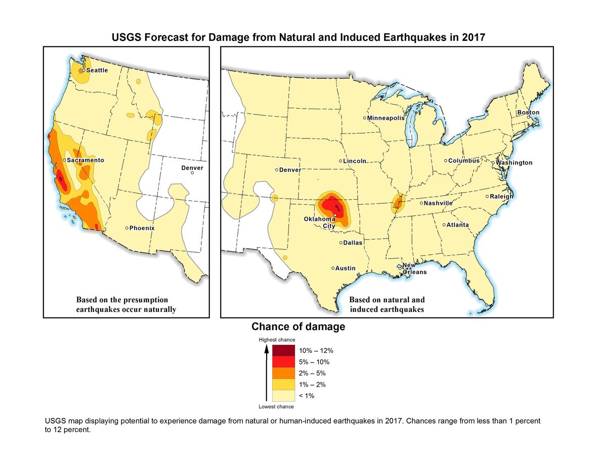
The United States Geological Survey (USGS) announced a new earthquake forecast on Wednesday, highlighting areas in the country that can expect to shake in the next year.
“Overall the rates of Earthquakes have declined in the central and eastern U.S. That’s the good news, that we’ve had these declines,” says Mark Petersen, chief of the USGS National Seismic Hazard Mapping Project. “But it’s a more complicated story because we’ve had more magnitude 5 earthquakes in Oklahoma than ever before.”
The decline, particularly in the eastern United States and around Oklahoma, is attributed to a drop in natural gas and oil production, though researchers aren’t sure if that’s due to lower prices driving down production, or regulations limiting the amount of wastewater injection—a practice that has been linked to earthquakes in the past.
In the western third of the United States, the likelihood of earthquake damage is forecasted based on the USGS’ 50 year outlook, issued in 2014. That outlook focuses only on the likelihood of damage due to naturally occurring earthquakes. East of the Rockies, the damage forecast gets more complicated.
Human-induced earthquakes are caused primarily by wastewater from oil and gas drilling operations being injected deep into the ground. While this practice occurs across the United States, the addition of these quakes doesn’t make a huge difference in the overall damage forecast in the quake-ridden west. But out east, where there are far fewer natural earthquakes, the addition of these oil and gas earthquakes can have a big impact.
The USGS has mapped human-caused earthquakes since 2015 and used the growing database of human-caused earthquakes for the first time in their earthquake damage forecast last year.
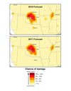
This year’s forecast is very similar to last year’s, with a slight decrease across the board—but there are still very active areas present in the seismically unsound west, and in oil and gas hotspots in Oklahoma and Kansas.
“The forecast for induced and natural earthquakes in 2017 is hundreds of times higher than before induced seismicity rates rapidly increased around 2008,” Peterson said. “Millions still face a significant chance of experiencing damaging earthquakes, and this could increase or decrease with industry practices, which are difficult to anticipate.”
A study published last December showed that reducing the amount of wastewater injections in Oklahoma could decrease the frequency of earthquakes, but also showed that in some ways, the damage has already been done. Wastewater from previous injections remains in the earth, raising the pressure underground and lubricating faults ready to break. That means that even as the number of earthquakes goes down, the risk of large earthquakes will still remain high for some time.
“Its great news that people have been regulating earthquakes in the state,” Peterson says. “They’re working so closely with us on trying to understand these results, that we’re making progress towards reducing the hazard in this area.”
Fewer earthquakes were felt in 2016 than 2015. That means that researchers are lowering the damage forecast for 2017 accordingly, though the possibility of large earthquakes—like the highly damaging one in Pawnee, Oklahoma last year, which set a record as the largest recorded in the state—remains. The large earthquakes that occurred last year in Oklahoma all occurred within the area that the USGS researchers forecasted would have the highest likelihood of earthquake damage in 2016.
It’s important to note that while this forecast does make an attempt to predict which areas will face damage this year, it’s not predicting any specific earthquakes. Predicting specific earthquakes remains an elusive, if not impossible goal.
“In this case what we’re trying to do is anticipate where future earthquakes will occur, how often they will occur, and how much the ground will shake,” Peterson says. “We’re not saying a particular sized earthquake might happen in this area at this particular time.”
While some areas of the U.S. are at more vulnerable than others, all fifty states are at risk of experiencing an earthquake. According to the new forecast, about 4 million people in the central and eastern U.S. are at high risk of experiencing either a natural or induced earthquake, not to mention the tens of millions of people in the west currently at risk. There is an effort to educate people across the country and around the globe to remember that when the Earth starts shaking, the best things to do are “Drop, Cover, and Hold On”.
In the future, Peterson hopes to make the model even more refined—incorporating additional data about differences in natural and induced earthquakes, refining models of how the ground shakes, and even making the forecasts on an accelerated time scale; six months instead of a year. He also hopes to add more data on induced earthquakes in the west, where the signal is currently drowned by the noise of natural rumblings.